
Treacherous UK tourist attractions thrill seekers will love
Danger zone

Lilly Trott/Shutterstock
The UK might not have much harmful wildlife or many extreme landscapes, but all manner of dangers still lurk amid its green and pleasant land. From mist-covered moors and hazardous high peaks to crumbling clifftops and polluted seawater, these are the most dangerous tourist attractions in the United Kingdom.
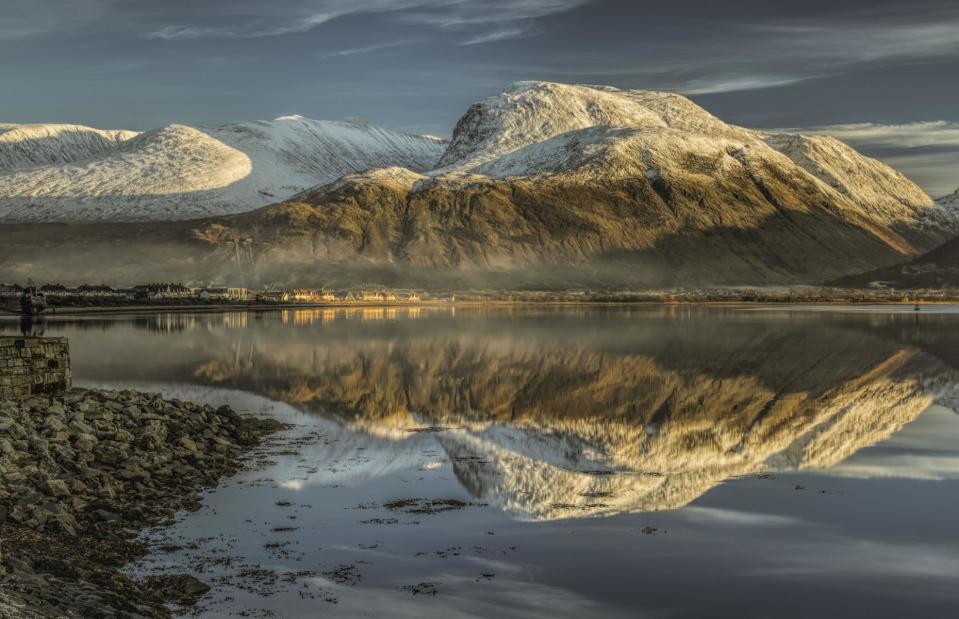
Ben Nevis, Highland, Scotland
Harry Feather/Shutterstock
At 4,413 feet (1,345m) above sea level, Ben Nevis is the tallest peak in the British Isles, and its soaring views are just one of the reasons 150,000 visitors come to conquer its slopes every year. It can be scaled via a few different tracks, the most popular (and easiest) of which is called the Mountain Track. The Carn Mor Dearg Arete (CMD for short) is a longer and more demanding route that traverses the notorious north face, while the Ledge Route is a challenging and occasionally confusing one-way ascent. For all these routes hillwalking experience, navigation skills, proper equipment and a high level of fitness are musts.
Ben Nevis, Highland, Scotland
Apostolis Giontzis/Shutterstock
Unfortunately, natural environments like this can be fraught with danger no matter how much you prepare. According to the peak’s visitor centre, more than 100 deaths have been recorded on Ben Nevis since 1849, with seven fatalities in 2017 – the worst year in recent history. Changeable and unpredictable weather conditions can be deadly at high altitude, causing people to lose their way and end up on riskier, more slippery parts of the peak. Avalanches are also a cause of concern in winter, along with dangerously high winds.
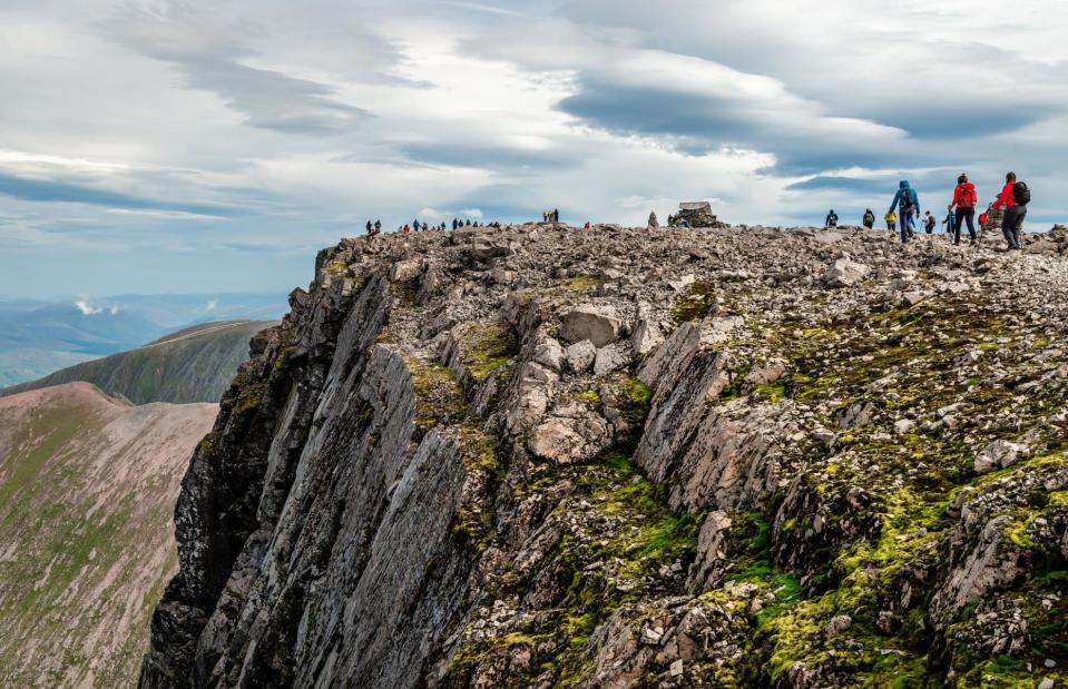
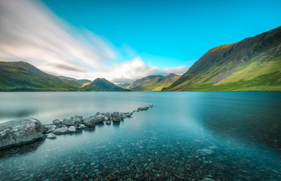
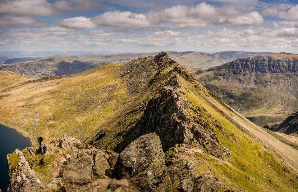
The Lake District National Park, Cumbria, England
Michael Conrad/Shutterstock
Mirror-like lakes and mighty peaks topped with breathtaking paths make the Lake District National Park a rambler's paradise. It's also popular with watersports enthusiasts, cavers and climbers – all activities that come with their own possible perils. In 2022, the Lake District Mountain Rescue Teams attended more than 600 rescues – that's almost two a day. Recent tragedies include a paddleboarder drowning on Ullswater and a hill climber falling to his death on Scafell Pike, England's highest mountain. Another accident hotspot is the Great End route up the Scafell Massif, where 71 incidents and 13 fatalities were recorded between 1949 and 2018.
The Lake District National Park, Cumbria, England
Brian Blades/Shutterstock
The park's water can be dangerous in a number of ways. First, the deceptively placid lakes can be extremely deep and cold, with a risk of cold water shock. Second, the Lake District is the wettest area in the UK, and slippery rocks and hazardous conditions can easily cause falls. Third, in winter the area's mountain roads and ridges are often covered with treacherous snow and ice. Perhaps the park's most perilous feature is Helvellyn, England's third highest peak, which plays host to the notorious Striding Edge (pictured), an infamous scramble that's exposed on both sides and has claimed many lives down the years.
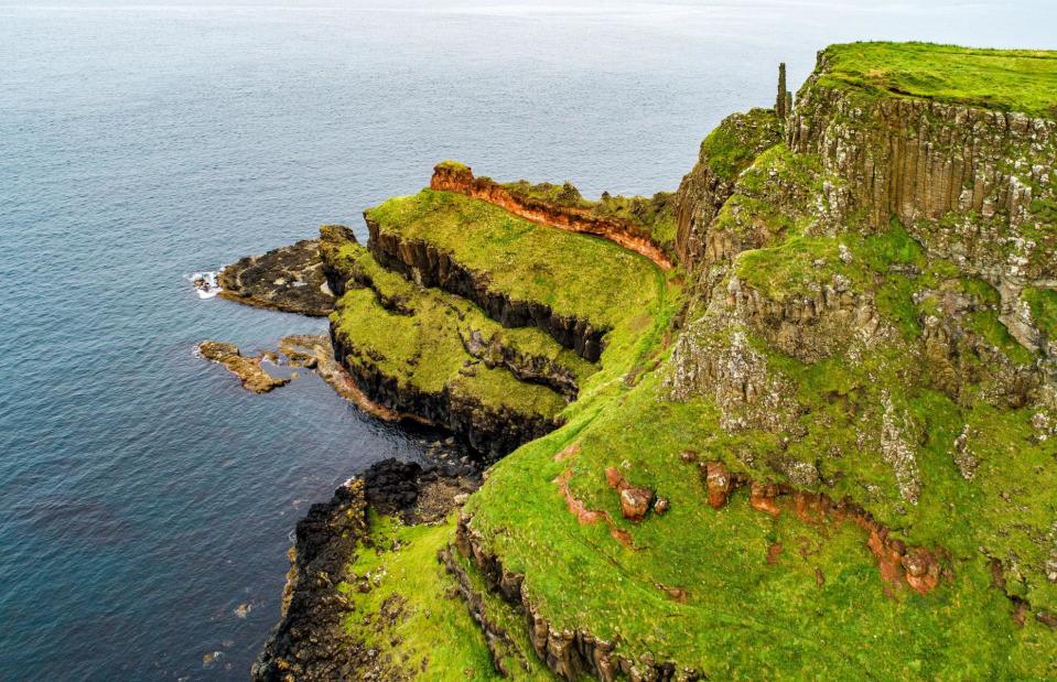
The cliffs of County Antrim, Northern Ireland
Nahlik/Shutterstock
The windswept beauty of County Antrim’s basalt coastline is delightfully soul-stirring and popular highlights include the geological wonders of the Giant’s Causeway, the famous Carrick-a-Rede Rope Bridge and the Gobbins, a cliffside path above turbulent seas that dates back to the Edwardian era. Created by volcanic activity long ago, these sheer and rugged rock faces are perpetually lashed by huge Atlantic waves. It's certainly spectacular, but this dramatic coastline is rife with dangers including unstable rocks and unfenced drops.
Love this? Follow us on Facebook for travel inspiration and more
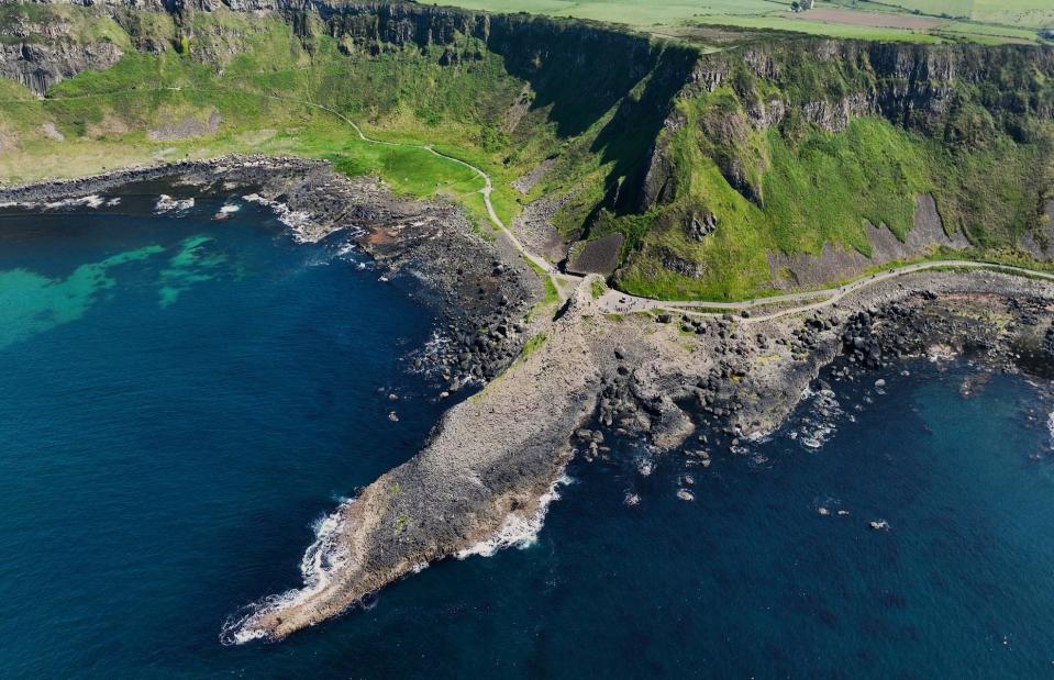
The cliffs of County Antrim, Northern Ireland
Ballygally View Images/Shutterstock
Coastal paths wind out around rocky headlands and allow walkers right up to the edge of the cliffs to spot wildlife and admire the ocean's power. But high winds and slippery conditions can make these views perilous and fatal slips have occurred – including the death of a seven-year-old boy in 2014. There have also been tragic accidents as a result of tombstoning – an extreme sport in which people jump from high cliffs into the sea. A notorious spot for shipwrecks, the craggy coastline is strewn with historic wreckage, including La Girona, a vessel from the Spanish Armada which was dashed on the rocks near Dunluce in 1588.
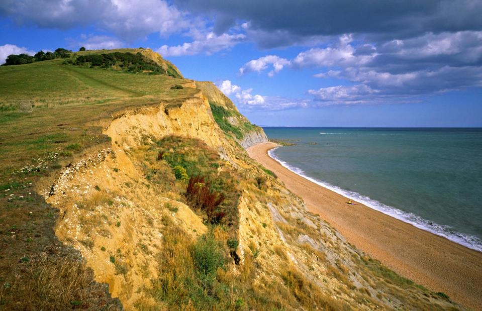
Jurassic Coast, Dorset and Devon, England
Otto Borik/Shutterstock
Golden coves, geological marvels and gorgeous seaside towns make the UNESCO-listed Jurassic Coast an incredible place to visit. But this dynamic coastal landscape is also extremely unstable and fragile, and mudslides and rock falls can make coastal walks very dangerous. Swanage, West Bay and Burton Bradstock have all seen large falls in recent years, and in 2012 a tourist at Burton Bradstock was crushed to death by a landslip. This year, a huge fall occurred at Stonebarrow Beach near Charmouth, blocking the beach off completely.
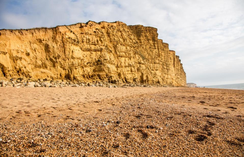
Jurassic Coast, Dorset and Devon, England
Robert Morris/Alamy Stock Photo
In 2021, the biggest rockfall in 60 years took place between Seatown (pictured) and Eype Beach. Signs urge walkers to stay away from the edge of the crumbling coastline and beach-goers to avoid sitting near the base of cliffs. The falls are unpredictable but storms, heavy rainfall and rough seas all increase risk. Unfortunately, directly after a storm is also peak time for fossil collectors to pick through the area's famous sediments, as storms can expose new fossils along the shoreline. Tombstoning off Dorset's famous rock arch Durdle Door has also resulted in tragedy, as has people attempting to climb parts of the cliffs.
Morecambe Bay, Cumbria and Lancashire, England
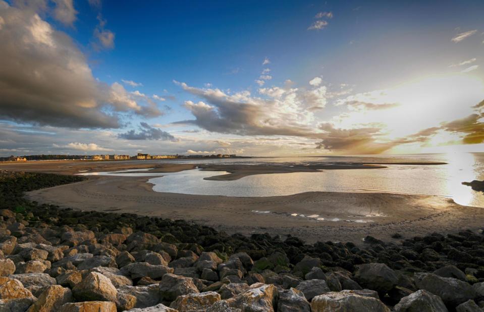
zetat/Shutterstock
Beautiful but deadly, Morecambe Bay is a broad, shallow estuary that stretches from the southwest coast of Cumbria to Fleetwood in Lancashire. Several rivers drain into it: the Leven, Kent, Keer, Lune and Wyre. It’s the largest expanse of intertidal mudflats and sand in the UK, and it's the second largest bay after the Wash in East Anglia. An increasingly notorious spot, dangers include quicksand, deep gullies and shifting channels along with notoriously rapid and fast-rising tides that race in and catch walkers unawares.
Morecambe Bay, Cumbria and Lancashire, England
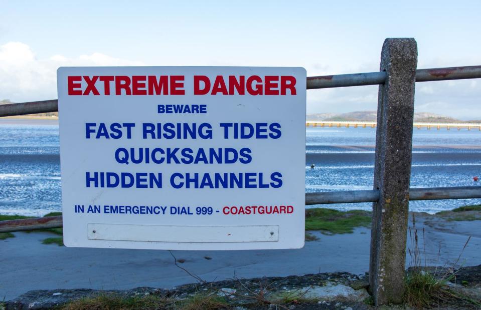
Matthew Figg/Shutterstock
The unpredictable terrain has led to many deaths, including the tragic drowning of 23 Chinese immigrants in 2004 who were caught by the sweeping tide when picking cockles, known to this day as the Morecambe Bay cockling disaster. At Arnside on the northeast side of the bay a siren is sounded twice before each daylight high tide to warn people of the incoming water, which is locally said to "race in faster than a horse". Despite all the warnings, however, many people still fall foul of the unpredictable tides when walking around Morecambe Bay.
Ramsey Sound, Pembrokeshire, Wales
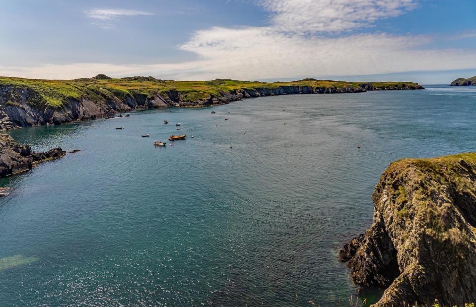
yackers1/Shutterstock
The powerful tides around Ramsey Sound are infamous too. Throw some hazardous rocks into the mix and this deep, narrow channel off the Pembrokeshire coast is not a good spot for a relaxing paddle. However, it is a popular place for white-water kayaking due to the hair-raising whirlpools and eddies, and is popular with boat trips thanks to top-notch wildlife-watching opportunities. Visitors can see seals, harbour porpoises, dolphins, choughs and peregrine falcons.
Ramsey Sound, Pembrokeshire, Wales
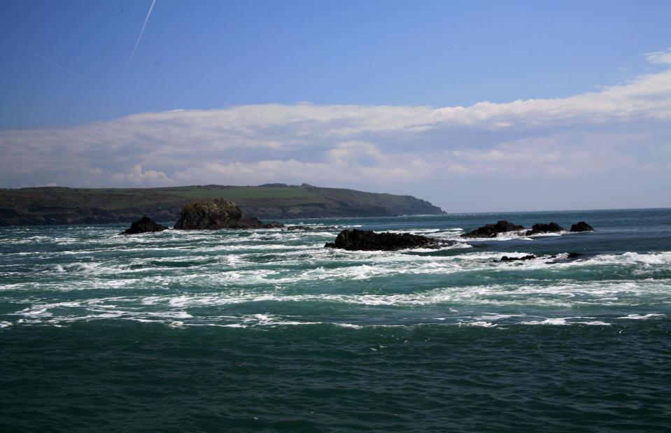
David JC/Shutterstock
Tourist boats go through the sound and around Ramsey Island, a RSPB nature reserve. It's home to a reef of spiky rocks which frothing waves crash through at terrifying speeds. The tides can reach speeds of up to eight knots creating thrilling rapids that challenge even the most fearless kayakers. The biggest tides occur just after full and new moons. History tells of numerous shipwrecks in these treacherous waters too, including one in 1910 when a lifeboat ran into the ragged rocks when returning to shore following a rescue.
Camber Sands, East Sussex, England
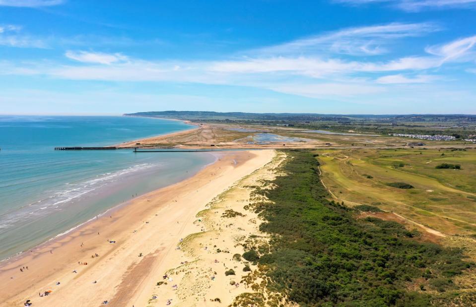
SuxxesPhoto/Shutterstock
A long stretch of golden sand backed by high dunes, Camber Sands is an alluring location for strolling, sandcastle building and swimming on the Sussex coastline. The exposed beach is often windy too, which makes the wide bay one of England’s most popular kitesurfing locations. However, the seven-mile (11km) beach is also one of the most hazardous stretches of the UK coastline, known for its riptides, fast incoming tides and sandbars that can quickly leave people stranded far from shore.
Camber Sands, East Sussex, England
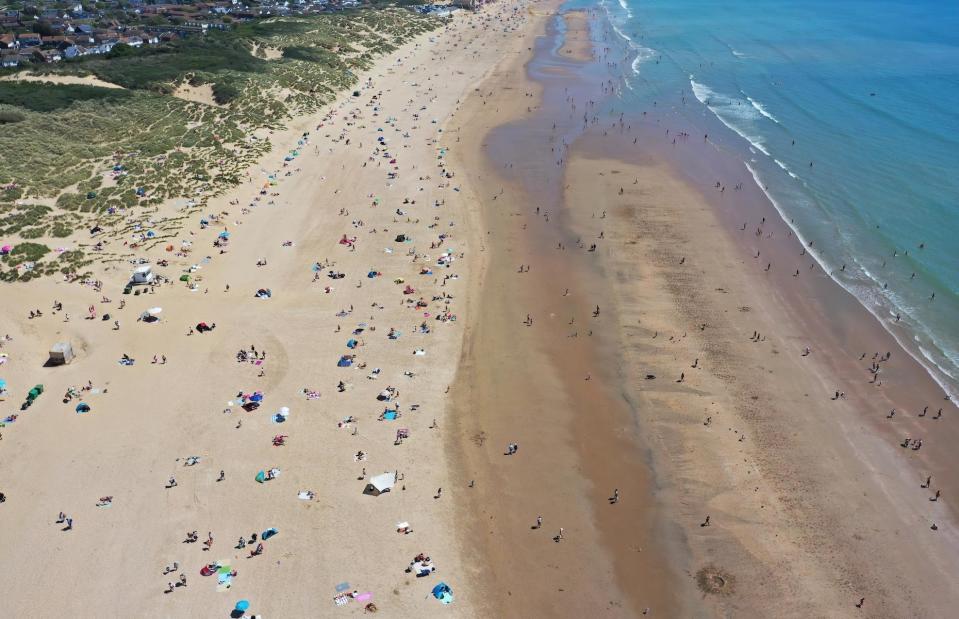
john_1/Shutterstock
Seven people drowned at the popular beach in 2013, five on the same day. Following the tragic events of that summer, lifeguards now operate on Camber Sands between April and October, and more visible safety signs warn of the dangerous currents and riptides. Swimmers are also warned not to swim in the harbour entrance, due to strong currents and boat traffic. There is also a separate watersports zone to avoid swimmers and kitesurfers colliding, although a kitesurfer died in 2019 after being blown into a concrete wall.
St Mary’s Bay, Kent, England
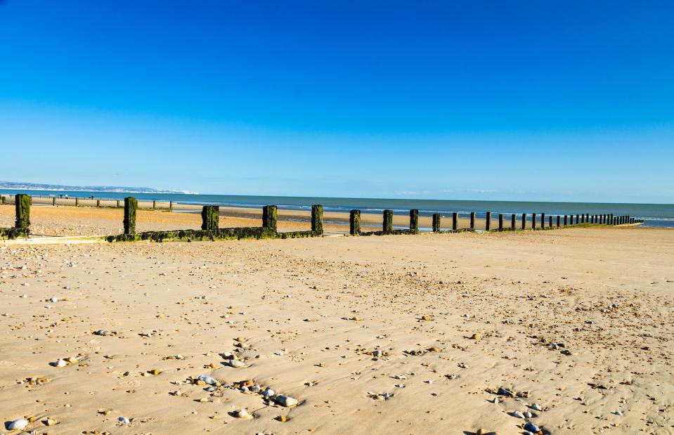
SuxxesPhoto/Shutterstock
The Kentish coast is awash with gorgeous beaches, from kitsch bucket-and-spade resorts to dramatic cliff-backed bays and atmospheric stretches of shingle. One spot you might not want to take a dip in, though, is St Mary’s Bay. The Environment Agency has issued a 'do not swim' alert at the sand and shingle beach in Hythe Bay for all of 2023, following the detection of unsafe levels of bacteria in the water.
St Mary’s Bay, Kent, England
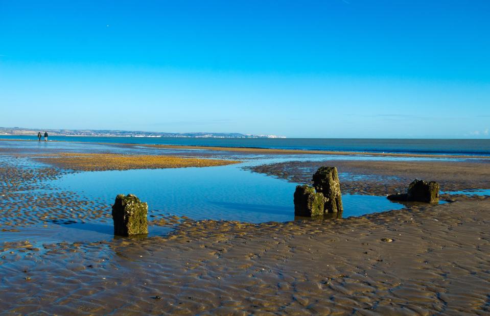
SuxxesPhoto/Shutterstock
The advice is based on samples taken from the bay between 2018 and 2022 (the bay received a 'poor' water quality rating in 2022 following a 'sufficient' one in 2021). Faecal matter was detected in the water, which may be linked to pollution from sewer overflows in the area. Signs have now been erected on the beach to warn against swimming. The popular beaches at Bognor Regis and Scarborough's South Bay have also been issued with 'do not swim' alerts this year, following a similar annual classification.
Mount Snowdon, Gwynedd, Wales
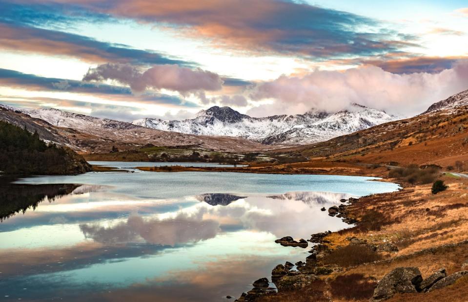
Valdis Skudre/Shutterstock
It can't quite match the scale and drama of the Alps, but Mount Snowdon or Yr Wyddfa in North Wales is a magnetic mountain to climb. It's also peppered with perils, especially for ill-equipped tourists who frequently ascend its slopes with little or no preparation. Britain's busiest mountain, more than half a million people climb Yr Wyddfa every year, and the Llanberis Mountain Rescue Team fields more than 200 call-outs annually. Snowdon claims multiple lives each year, mostly in winter. There are six routes to the summit, some of which traverse accident blackspots like the East Ridge, Trinity Face and Crib Goch, a deadly ridge which should be attempted by skilled mountain walkers only.
Mount Snowdon, Gwynedd, Wales
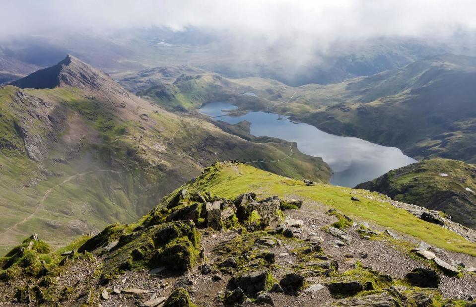
Lilly Trott/Shutterstock
Aside from poor preparation, the main reasons climbs go wrong on the 3,560-foot (1,085m) mountain are the weather, poor ground conditions that can lead to slips and falls, and walkers getting lost. As with all mountains, conditions are unpredictable, with snow common in winter and dense hill fog that can disorientate walkers. Lightning is another rarely considered hazard and two hikers were struck at the summit in 2021. An increase in visitor numbers has also resulted in queues to reach the summit and the potentially fatal erosion of footpaths.
The Strid, North Yorkshire, England
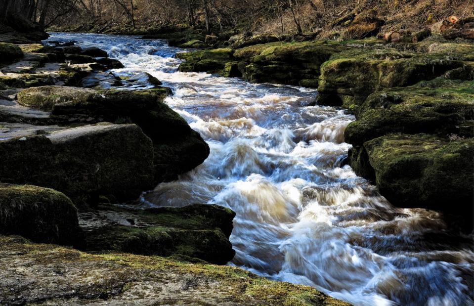
allouphoto/Shutterstock
Tumbling through an ancient oak forest in the grounds of Bolton Abbey in the bucolic Yorkshire Dales, the Strid is a deceptively picturesque section of the River Wharfe that's been nicknamed 'the stream that swallows people' and 'England's killer creek'. It's a series of waterfalls and rapids that gush through the rocks at great speed and etymologists will be well aware of the channel's dangers, as its name is probably a corruption of the Anglo-Saxon word 'stryth', which means turmoil or tumult. The highly dangerous waterway has claimed numerous lives over the years, including those of a honeymooning couple in 1998.
The Strid, North Yorkshire, England
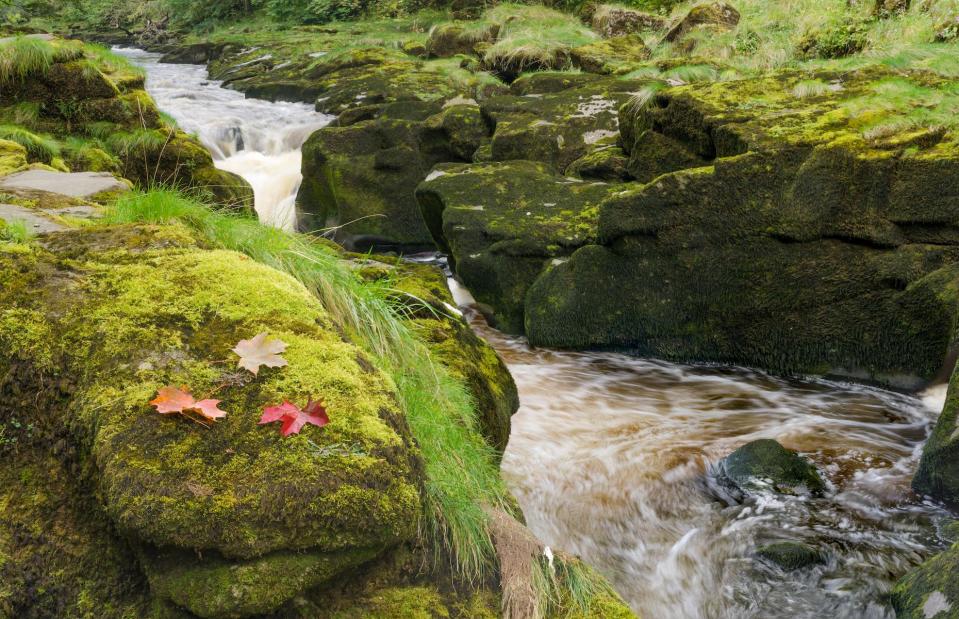
Andrew Fletcher/Shutterstock
A pinch point in the river, the Strid's churning water is dangerously cold and fast-flowing with strong undercurrents, while its course is pocked with rocky outcrops and underwater caves. The Strid's narrow channel is also deceptively deep, even more so after heavy rain when water levels have been known to rise five feet (1.5m) in less than a minute. An information board at the site says that the Strid is over 30 feet (9m) deep or "more than two double-decker buses on top of each other", and even standing on the mossy rocks that line its banks carries danger as it’s all too easy to slip in.
Prestonhill Quarry, Fife, Scotland
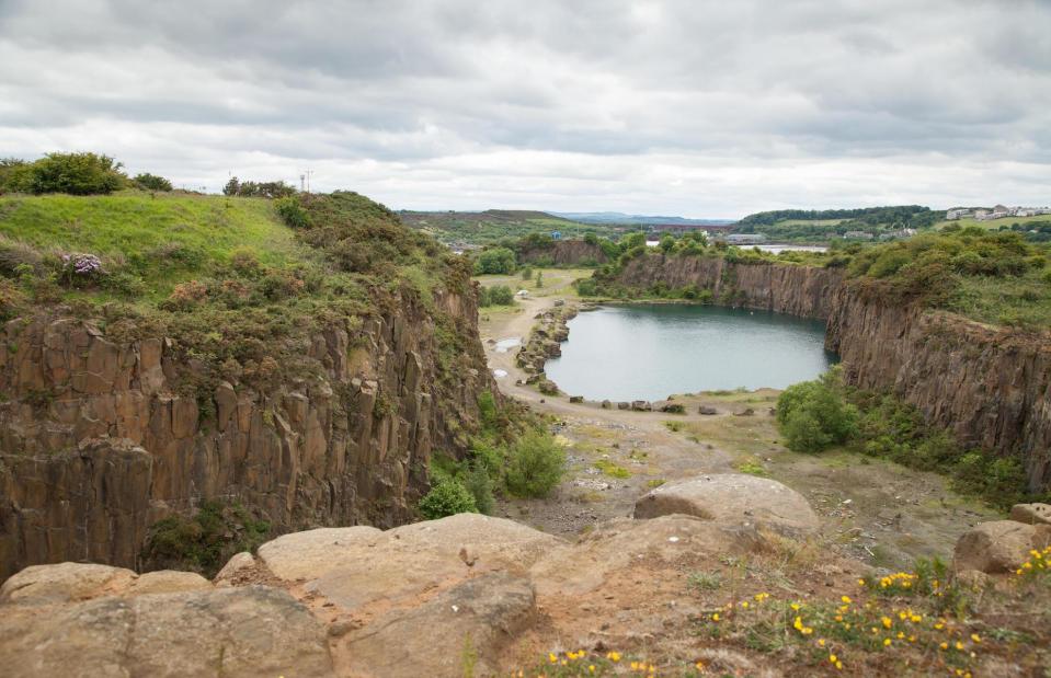
Porridge Picture Library/Alamy Stock Photo
On a hot and muggy day there are few things more tempting than leaping into a cool body of water. But the urge to jump into the freezing waters of Prestonhill Quarry in Inverkeithing, Fife, has led to several tragedies. Nicknamed 'death trap quarry' by the media, the former dolerite quarry has claimed four lives in the last 50 years – three of them in the last 10. A 12-year-old boy fell to his death there in 1973, while two 18-year-old boys drowned there in 2014 and 2015 respectively. In 2017, a 36-year-old teacher became the quarry's fourth victim after failing to resurface following a night-time scuba dive.
Prestonhill Quarry, Fife, Scotland
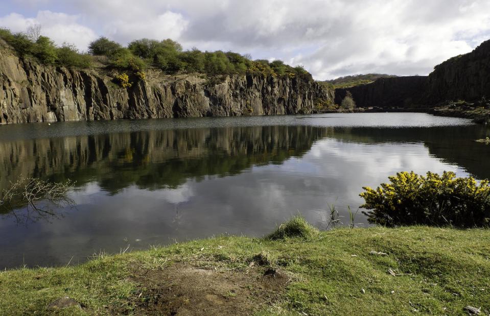
Porridge Picture Library/Alamy Stock Photo
Despite the deaths, warning signs and security fences, some people still access the site to swim. The heatwaves of recent summers have drawn youths to tombstone into the notorious quarry’s beguiling waters, much to the dismay of locals. There are plans for a major overhaul of the area to create a mixed-use development that will include houses, holiday homes and restaurants. If approved, the plans will see the contentious quarry finally filled in and its dangerous rock faces removed.
Beachy Head, East Sussex, England
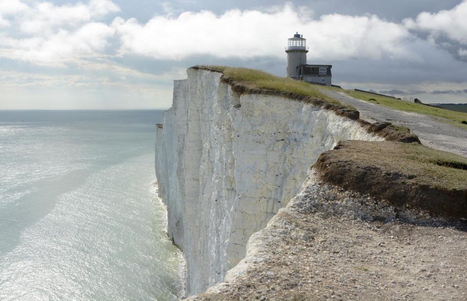
Chrisdorney/Shutterstock
A world-famous beauty spot, Beachy Head's bone-white cliffs and red-and-white-striped lighthouse are extremely popular with walkers and sightseers, especially in summer. Towering 530 feet (161m) above the sea, the chalk sea cliffs are the highest in Britain, and have unfortunately developed a sad reputation as a suicide spot. As well as the obvious peril of standing too close to the edge, these crumbly cliffs are also prone to chalk falls, which can endanger people both on the cliffs and below them. These falls occur fairly regularly all along the cliffs, which stretch from Eastbourne past Beachy Head and the Seven Sisters, all the way to Seaford Head.
Beachy Head, East Sussex, England

Nick Hawkes/Shutterstock
Foreboding cracks have appeared near the edge of the cliffs in some places, so some sections have been roped off. Despite warnings, visitors often pose for dangerous cliff-edge photographs – and multiple people have died in recent years while attempting to capture dramatic shots. Base jumpers have also been seriously injured after leaping from the cliffs. Down on the beach, as well as falling chalk there's a risk of being stranded by fast incoming tides. The seas off Beachy Head are famously windy and unpredictable, and it was the area's dreadful shipwreck record that led to the erection of its famous lighthouse below the cliffs in 1902.
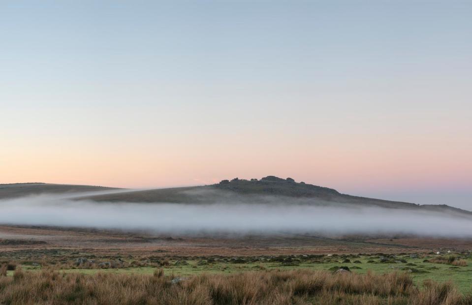
Dartmoor National Park, Devon, England
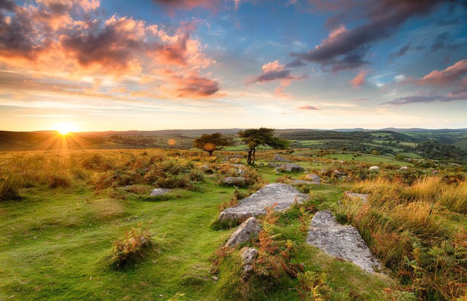
Helen Hotson/Shutterstock
Vast sweeps of high moorland and ancient woodland, jagged granite tors, mysterious stone circles and wide open skies: Dartmoor is a place of brooding beauty and one of the UK’s greatest wildernesses. It’s also steeped in local folklore that adds more than a whiff of mystery to its haunting landscape. Notorious for bogs and mires, the landscape can be fraught with real danger if you don’t have your wits about you. Hikers can be caught out by the moor's changeable weather, and thick mist can descend quickly and mask important navigational landmarks.
Dartmoor National Park, Devon, England
Matt Gibson/Shutterstock
The tors are a magnet for climbers but have previously caused fatalities, while the deep, cold and potentially dangerous waters of Dartmoor's quarries and rivers are popular with wild swimmers. The moorland livestock can be unpredictable, especially around dogs, and the appearance of Dartmoor hill ponies through the mist on the park's narrow and twisting roads can startle and distract drivers. If you’re exploring north Dartmoor, you’d be advised to check firing times as some areas are used for training by the Ministry of Defence. Both the north and south moors were used as training grounds during the Second World War, so there is also a small risk of encountering unexploded ordnance.
The Cat and Fiddle Road, Derbyshire, England
Anthony Dillon/Shutterstock
More windswept moors, rugged crags and mysterious tors beckon in the Peak District. The national park is a dream for outdoorsy types, and it boasts some seriously scenic roads for soaking up the sumptuous scenery. The so-called Cat and Fiddle Road is one of them. The seven-mile (12km) stretch, named after the inn which sits at its summit, sweeps between Buxton and Macclesfield and promises drivers hairpin bends, steep gradients and wide-open views of the undulating landscape. It’s particularly popular with motorcyclists, but it's also often called the most dangerous road in Britain.
The Cat and Fiddle Road, Derbyshire, England
Daniel_Kay/Shutterstock
Sadly, the snaking route has claimed many lives. At its peak in the late-noughties there were around 10 fatal accidents every year on the road, which has blind bends, steep drops and dry stone walls along much of its length. Motorcyclists make up around 70% of the road's victims, and winter makes it even more perilous, with freezing temperatures, reduced visibility and an increased risk of skidding. A strict speed limit of 50 miles per hour (80km/h) operates on the Cat and Fiddle, and speed cameras were installed along its length in 2010 in an attempt to slow down thrill-seekers. Motorcycle-friendly crash barriers have also been installed at particularly lethal sections.
Now learn about the most dangerous tourist attractions in the world

