
Seven British roads rich in history and beauty
Away from the not-so-Smart motorways and commuter belts, the UK has some superb high roads and slow lanes, rewarding not only because of the landscapes and sights they uncover, but also because of the stories they tell. Here are seven worth exploring.
A tour of Lancashire
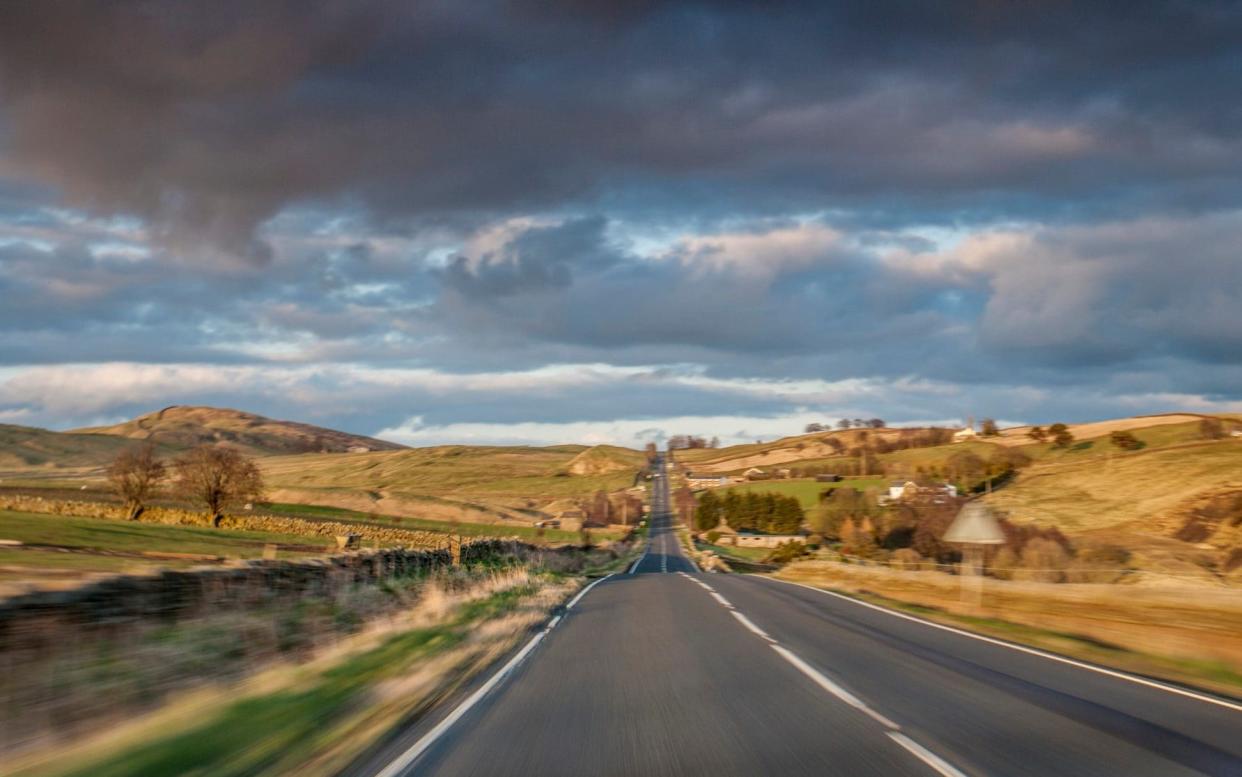
The A580 dual carriageway, or East Lancs Road, connects Liverpool with Manchester and was, on its completion in 1934, the United Kingdom’s first purpose-built inter-city highway – or, less prosaically, the first major new road to be built since Roman times. Other trunk roads were laid over old ways, and this was even true of the motorways which came later.
Seemingly straight-as-an-arrow when you drive it, the East Lancs has some kinks, as at Leigh where it veers northward to get round Chat Moss – the famous peat bog that presented a serious challenge to the builders of the Liverpool and Manchester Railway.
The appearance of such a major new road arguably marked the shift from the train to the motor-car, though the visionary builders of the A580 installed a bike path along its length. Cyclists like the fact the road is generally flat, passing below Billinge Lump – at a measly 587 feet the regional highpoint – near St Helens, as well as several other former mining and mill towns on the West Lancashire Plain.
Border battlegrounds
Not to be confused with the nearby Roman-era Military Way, the Military Road, a 31-mile section of the B6318 between Heddon-on-the Wall and Greenhead in Northumbria, was built in 1746 under orders of General Wade, charged with improving logistics between forts and barracks to support the English armies against Bonnie Prince Charlie’s Highlanders.
It was part of a network of such roads that includes today’s West Highland Way and parts of the National Cycle Network. After Culloden, troops were garrisoned throughout Scotland using General Wade’s roads.
The road straddles three counties and crosses a national border. The Hadrian’s Wall highlights of Vindolanda and Housesteads, the Muckle Moss National Nature Reserve, Aydon Castle – a focal point of border skirmishes in the Middle Ages – and the Twice Brewed Inn in the village of Once Brewed all lie off it.
Britain’s northernmost road

The Shetlands, with its dramatic cliffs, beaches, islets and Iron Age brochs, might not sound like the kind of place you’d go for a driving holiday. But the long road from Sumburgh airport to the top of Unst – the northern extremity of the UK (a wee bit higher up than Oslo) – makes for a wonderful Patagonia-like ride through the strangely bare and rolling hills of the archipelago.
The two car-ferry crossings slow things down and are akin to decompression chambers: the more you travel, the calmer you feel. Shetlanders will happily explain that this is because you’re putting ever greater distance between you and the dens of vipers that are Edinburgh and London (they call their big island the Mainland). The A970 is the southern section, passing Lerwick.
From Hillside, you veer northeast on the A968, skirting the coast and rounding the Sullom Voe oil terminal before traversing Yell and Unst. You’ll need the B9086 to finish the job, arriving at Hermaness National Nature Reserve to celebrate your lofty latitude – until the local great skuas (known here as bonxies) start dive bombing and combing your hair with their hooked claws.
Searching for Eleanor Crosses

Every day Londoners walk past the Queen Eleanor Memorial Cross in the forecourt of Charing Cross station without a glance – and without connecting it to the place name. The original 12 Eleanor Crosses were erected by a disconsolate Edward I after his wife, Eleanor, died in 1290.
His marriage to the daughter of Ferdinand III of Castile in 1254 was politically unpopular but passionate and productive; they had 16 children (though only a few reached adulthood).
Eleanor accompanied Edward on a crusade and is reputed to have saved his life at the siege of Acre in 1272. She was travelling north with him to fight the Scots in November 1290 when she succumbed to a fever and died. Only three of the medieval crosses have survived, at Geddington, Hardingstone and Waltham Cross.
Fragments, replicas, memorials and, at St Albans, a clock tower mark other sites, which are listed here and well suited to a slow, stopping drive up the M1 and A1 (Great North Road) – with romantic/ecclesiastical detours as per the map – ending at Lincoln Cathedral, where Eleanor’s viscera were buried.
Manchester’s mini-motorway

The UK is littered with unfinished road projects, from Outer London’s North Cross Route to Liverpool’s inner-city motorway. The M67, conceived in 1967, was planned as a trans-Pennine highway to link Manchester and Sheffield, two of England’s largest conurbations.
Contributors to the Pathetic Motorways website debate whether tunnels or bridges would have been allowed to carve up the Peak District, the UK’s first national park and of totemic significance to access campaigners.
The road was proposed after the Beeching reports led to the closure of the Manchester-Sheffield railway through Woodhead. But the motorway never got built, apart from a five-mile section that serves as a bypass for everyone except the people of Denton and Hyde for whom it is a town-centre asphalt canyon.
It’s not the UK’s shortest, however, not even close: the M898 in Renfrewshire measures less than a mile. Drive the M67 as an amuse bouche to the main course of either the Snake and Woodhead passes that it was intended to replace.
The Cotton Famine Road

You can only drive a car along the northern and southern ends of the ancient Rooley Moor Road byway, which used to be called Catley Lane. In medieval times it was used to take wool to Whalley Abbey, the ecclesiastical powerbase of the region.
Today it connects Rochdale with the Rossendale valley, and a sizeable section is known as the ‘Cotton Famine Road’. When the American Civil War brought cotton trading to a halt, Lancashire mill workers sent a letter of support to Abraham Lincoln in 1862; he replied personally, acknowledging the hardships the people had had to suffer.
Rather than leave local workers unemployed, the Board of Guardians charged with administering the Poor Law assigned them the task of improving a 1.5-mile section of the road the moor. Around a third of a million setts were laid; the cream-coloured gritstone has led to it being dubbed the Yellow Brick Road. At 1,500 feet it’s a great place for views, and is popular with walkers, runners and cyclists. Read more at rmnf.org.uk
The wonders of Wales

Wales has some cracking roads, such as the A465 Heads of the Valleys Road and the A40, which runs from Fishguard to High Holborn. But the A470 is a fabulous trans-Wales trunk road, especially prized because Wales doesn’t have any motorways running north-south (it hardly has any motorways at all). Cardiffians who want to see the north have to ride the 186 miles of this, their nation’s longest road, all the way to Llandudno.
It tells Wales’ industrial and cultural history en route, passing close to or through Tiger Bay, Merthyr Tydfil (iron), the Rhondda valley (coal) and Blaenau Ffestiniog (slate), the Brecon Beacons National Park, the Green Desert of Wales and mighty Snowdonia.
It even manages to skirt Llanrhychwyn, home to Wales’ oldest parish church. In 2014, BBC Radio 4 aired a programme called The Welsh M1, hosted by Cerys Matthews, about the A470 – still available here.

