
The new King Charles III England Coastal Path is intended to benefit all. Here’s where to walk
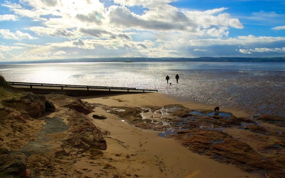
The sky over East Quantoxhead in north Somerset is dismal. Tramping down the path to the beach through fields of yellow rapeseed, Natural England civil servant Neil Constable takes the six-inch deep mud in his stride. A crack of lightning and a rumble of thunder herald the opening of the clouds as a torrential downpour engulfs him.
It’s an inauspicious day to be sharing the merits of the soon-to-be-completed King Charles III England Coast Path. Still, after fourteen years leading this project, Constable has dealt with more than a little rain.
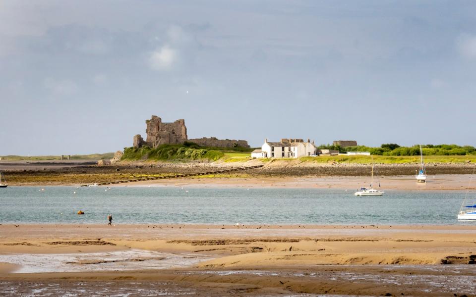
“This beach is stunning,” he explains, “it’s made from the same limestone as the Jurassic Coast, going under Devon and reappearing here. Geologists say this is more impressive though.”
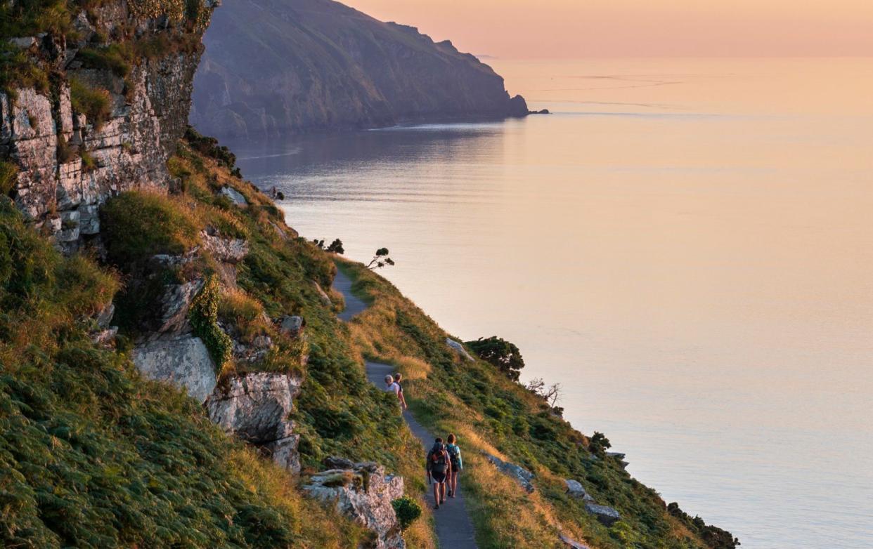
As the path nears the cliff-edge, the geologists are proved right. Swirls of wave-carved rock hide pools glistening in the hazy light. It’s a spectacular view and for Constable, it typifies exactly what the project has all been about.
“The existing ‘coastal path’ went miles in-land but we have brought it back to this wonderful stretch of coast which was forgotten due to poor access,” Constable enthuses.
The England Coast Path project originated in 2009 under Gordon Brown’s government. The Marine And Coastal Access Act created a duty for DEFRA and Natural England to establish a long-distance walking route around the entire coast of England from Carlisle to the Dee Estuary, then from the Severn Bridge around to Berwick-Upon-Tweed.
There were always public trails, bridleways and beaches that skirt the nation’s coast, but these are a patchwork, interrupted by private land every two miles on average, particularly in the North and South East. The new trail creates one continuous route.
“Being outdoors is good for your health, physical and mental; the coast perhaps even more so. Something draws us there, the space, the openness, the movement of the sea,” says Constable. “Research shows there are huge benefits for the health and local economy of communities near national trails. This is about sharing that.”
While the project began as Labour policy, every subsequent government has endorsed it. Then-secretary of state for Environment, Food and Rural Affairs Thérèse Coffey was so proud of it she renamed it for King Charles III’s coronation.
Charting a route around 2,706 miles of coastline was a mammoth task, requiring an experienced pair of hands. Constable had been at Natural England for almost a decade, managing the South West Coast Path. “The change of government in 2010 led to concerns about feasibility so I was asked to lead a proof of concept around Weymouth Bay where sailing events for the 2012 Olympics were held.”
Though the legislation set the broad parameters of what the path should be; sea views, safety, and accessibility; it was up to Constable to drill into the specifics of the route. Buildings, gardens, registered parkland, arable farmland, working quarries, railway, airfield and school land were exempted, but much of the planning was about negotiation.
“The only way this was going to work was if we brought people with us,” says Constable. “We needed a lot of people to buy into the creation of new paths, or widening access on pre-existing trails and we had to convince them it was worth their while.”
There was no compensation to landowners (up to March 2024, the project had cost £16m, with £5m of that drawn from EU grants) so it was vital to bring them on board voluntarily.
In some cases, new rights of way were popular. If a trespasser crosses a private field to access the coast, then gets into trouble, the landowner is liable; on a public right of way, it’s their fault. There was also the chance to open up local coastlines to local people for dog-walking and family days out. Financially too, the impact of a national trail through tourism proved an incentive – DEFRA analysis found £334 million was spent in local economies by people walking on English coastal paths.
Happily, most landowners have engaged positively. “We’ve published proposals for 99.1 percent of the path, working with 25,300 legal interests – the rate of objection is 2.42 percent,” beams Constable. The figure is almost unprecedentedly low. “That’s because the team at Natural England have listened to the people who work the land to discover what works for everyone.”
The Weymouth pilot proved successful, with the new paths enjoyed by thousands of visitors during the Olympics. It was full steam ahead.
Things didn’t always go to plan. A 2018 ruling from the European Court Of Justice decreed that nature conservation assessments should be more rigorous, forcing Constable’s team to resubmit proposals. The pandemic slowed things down too, and the subsequent price shock sent the cost of materials for building paths soaring. Coffey’s name change required new signposts for already-finished sections.
Constable and his team kept soldiering on. Currently, 1,040 miles are ready to walk, 1,255 are approved and paths are being worked on. 383 miles are awaiting approval.
Just 26 miles of coast (covering Lulworth Ranges, Osborne House on the Isle of Wight, and the Rother Estuary/Rye/Camber Sands) are left to be proposed, which Constable hopes will be done by summer. Ultimately it’s for Steve Barclay, the secretary of state for Environment, Food and Rural Affairs to approve the routes and then the King Charles III Coast Path will be complete.
Some of the coast path will absorb existing national trails such as the South West Coast Path around Devon and Cornwall. Some of it will be paths which already exist but need some work – new signposts, bridges, steps, ramps, and gates.
Some of it, like in East Quantoxhead, is totally new, offering easy access to coastlines which have never been open to the public.
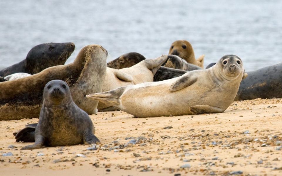
“One of the places which was a real eye-opener to me was just north of the River Tees near Middlesbrough,” says Constable. “It’s an area with a lot of oil rigs, refineries, and blast furnaces. But between the heavy industry, there are creeks with seals, amazing birdlife; real wilderness. Opening that up to people felt special. It’s a totally undiscovered gem.”
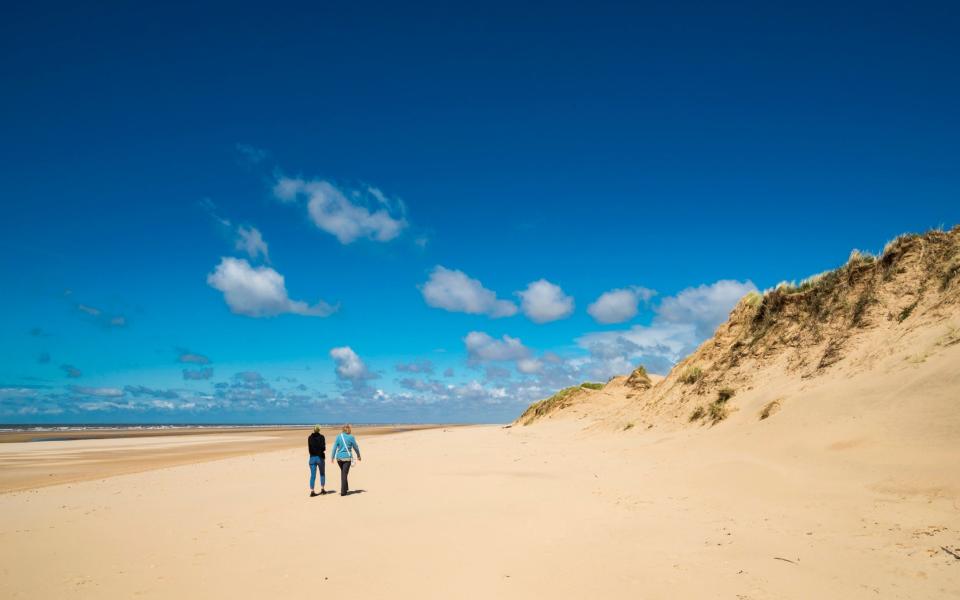
Other spots wildlife lovers will enjoy, predicts Constable, include the chalk downs of the southern coast where rare orchids and butterflies abound. Norfolk beaches are renowned for their grey and harbour or common seal nurseries. The coastal dunes of Formby, Merseyside provide habitat for great crested newt, natterjack toads and sand lizards.
For bird lovers, muddy estuaries from the Thames to the Humber, Morecambe Bay and the Severn will delight, with thousands upon thousands of wintering birds.
In the summer, the nesting habitats of cliffs such as those found around Durham are used by kittiwake and fulmar.
As the coast continues to evolve, so will the path. It is already dynamic. Sections on the East coast offer different routes depending on season to avoid seal pupping. Around the Lulworth Ranges, the path will diverge from the sea for parts of the year when the army uses the area for firing practice.
Some sections warn visitors to keep dogs on leads to avoid disturbing nesting birds. In East Quantoxhead, the path is tidal; visitors are warned to check the tides before descending onto the beach.
“It’s about finding a balance so people can explore the natural wonders of Britain, without destroying them in the process,” says Constable. “We want to give people the confidence and the competence to enjoy nature.”
The path will evolve in a literal sense too. Unlike traditional rights of way which operate on fixed lines, the coastal path will roll backwards. In the East Riding of Yorkshire, coastal erosion is the fastest in Europe, so as the sea comes in, the path retreats from it.
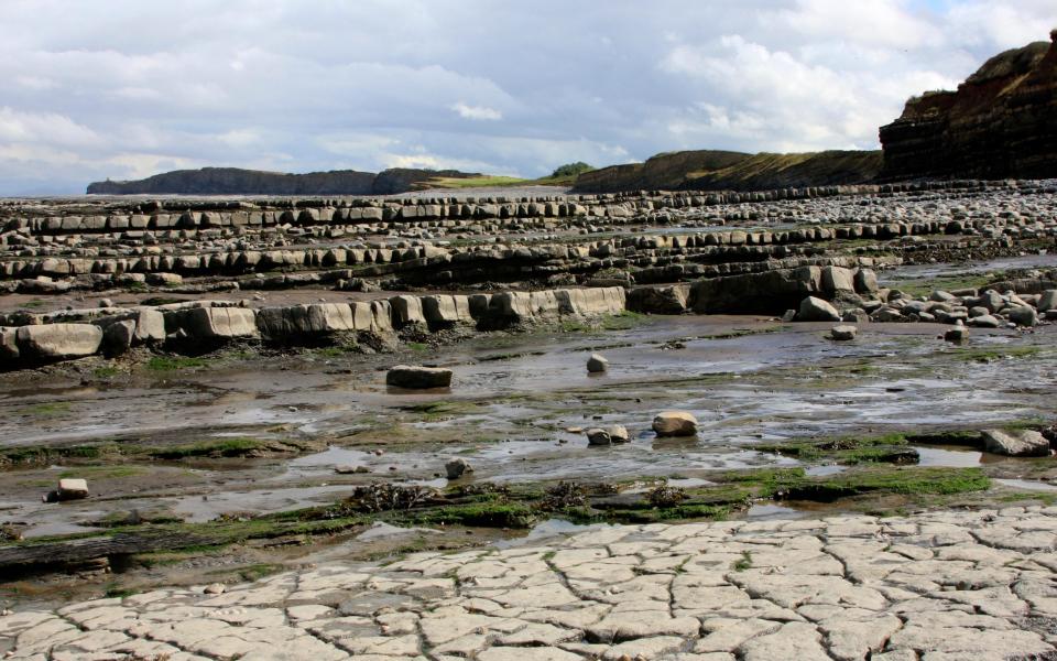
Clouds crack and late afternoon rays spill onto the beach on the descent from the clifftop. Newly made waterfalls thunder the rainwater off the fields, making gleaming pebbly rivers criss-cross the moodily magnificent geological formations.
Over the estuary, one can make out Cardiff. Until now these views have been restricted to only those who had a caravan at the obscure site perched atop the cliffs. Now they belong to everyone.
“It’s humbling, to be tasked with making something which will outlive me,” Constable says. “No one will remember the people who made the England Coast Path, but thanks to it, this vital part of Britain’s island story is going to be accessible for everyone, forever.
“This hasn’t always been the easy path, but it’s definitely the one worth taking.”

