
Cities from the UK and around the world that could soon be underwater
Sunken treasures

Lucy Brown - loca4motion/Shutterstock
Rising ocean waters will completely inundate many coastal land areas within the next three decades, according to data produced by Climate Central. In order to better project annual flood levels, they use a new digital elevation model called CoastalDEM.
These are some of the incredible places in the UK and around the world that could be underwater by 2050 if major steps to prepare for rising seas aren't taken.
Bruges, Belgium
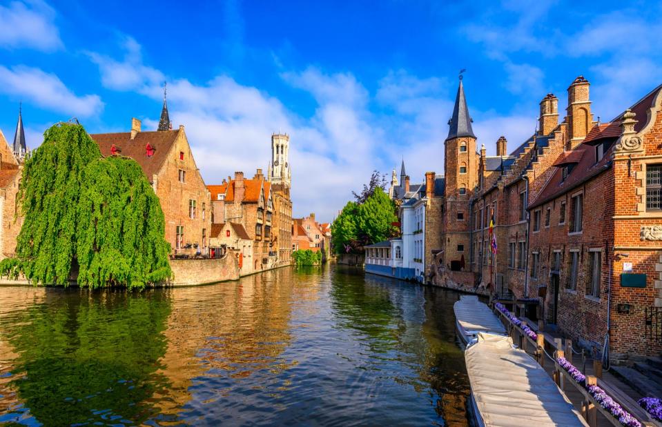
Catarina Belova/Shutterstock
Along with much of the low-lying North Sea shoreline, Belgian’s coastline and its pretty seaside towns are extremely vulnerable to rising sea levels. And so too is the picturesque city of Bruges in the country's northwest. The UNESCO World Heritage Site is famous for its winding waterways, cobbled streets and striking bell tower, but floods could do severe damage to its exquisite medieval center.
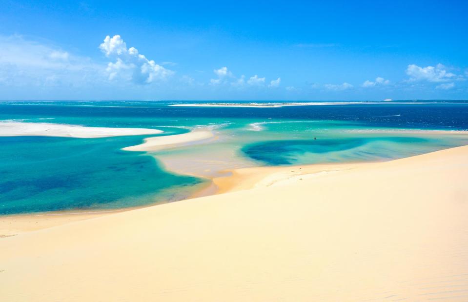
East Anglia, UK
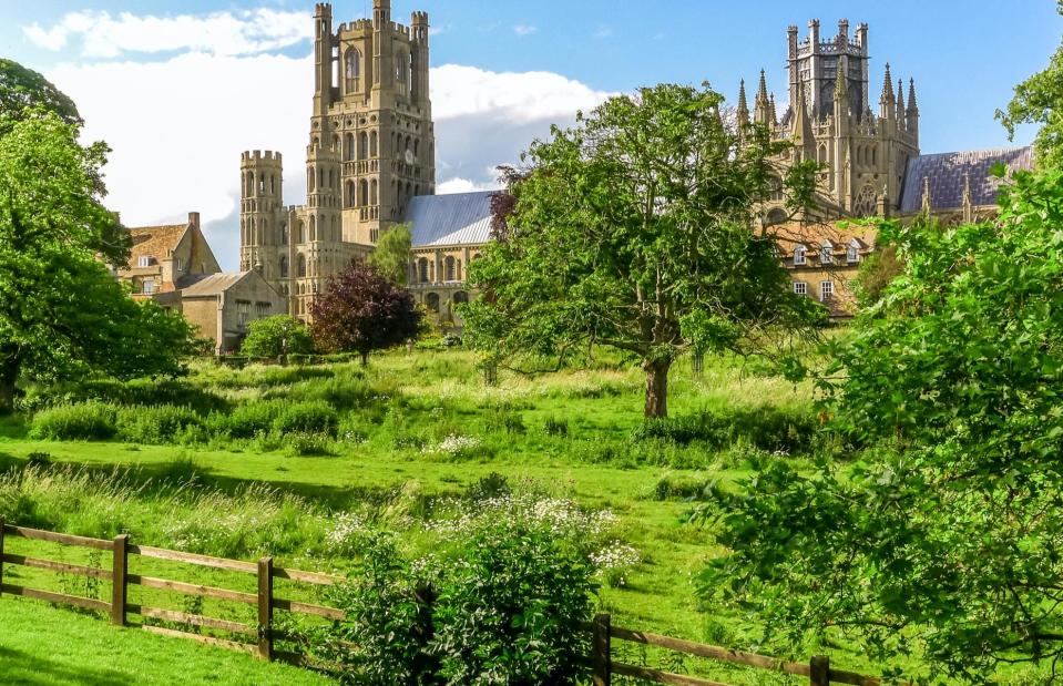
Lucy Brown - loca4motion/Shutterstock
Climate change spells potential disaster for large parts of low-lying East Anglia, England, including the spectacular North Norfolk coastline, a designated Area of Outstanding Natural Beauty, and the Wash National Marine Reserve. The predicted coastal flooding would totally swamp the Fens, a coastal plain, reaching down to the Saxon city of Ely and touching on Cambridge.
Built on an island in the marshlands, Ely is famous for its magnificent medieval cathedral (pictured).
Delft, the Netherlands

S-F/Shutterstock
The Netherlands' Delft, another canal-lined city of medieval squares, exquisite architecture and priceless art, is also at risk of being inundated by rising sea levels by 2050, along with Rotterdam and parts of Amsterdam. As the birthplace of artist Vermeer, the city has a rich history.
However, its medieval Old Town, which counts a vast square and beautiful Delft City Hall among its landmarks, could be irrecoverably damaged by flooding if the North Sea continues to rise at current levels.
Ribe, Denmark
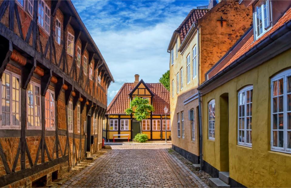
Elenarts/Shutterstock
Along with the entire Wadden Sea coastline, Denmark’s oldest town, Ribe, also faces an uncertain future due to sea levels in the North Sea. The well-preserved town dates back to the 9th century, when it was settled by Vikings and became an important North Sea port – today it's known for its pretty cobblestone streets, half-timbered houses and medieval churches.
The Wadden Sea itself is a marvel too: as the largest tidal flats system in the world it extends along the coasts of Denmark, Germany and the Netherlands and is a UNESCO World Heritage Site due to its unique habitats and biodiversity.
Tabasco, Mexico
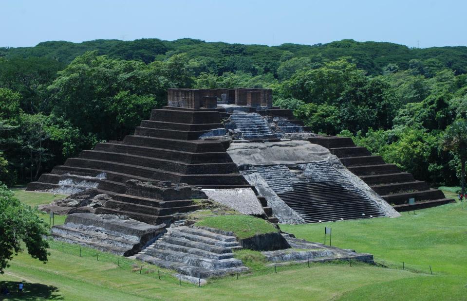
Marotoson/Shutterstock
With a coastline on the Gulf of Mexico, the low, flat state of Tabasco is no stranger to flooding – and it could eventually be completely consumed. The rural region is covered in wetlands and forest and is already subject to seasonal floods, but the rising sea levels could submerge it entirely.
This would threaten impressive archaeological sites, such as the Mayan ruins of Malpasito and Comalcalco, and its charming colonial cities. Parts of Mexico's Yucatán Peninsula and Baja California are also vulnerable to global sea-level rises.
Panama City, Panama
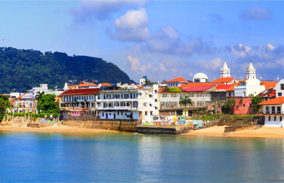
GTS Productions/Shutterstock
Panama City’s Casco Viejo and its exclusive Costa del Este neighbourhood are likely to be submerged by 2050. The city was founded in 1519 by Spanish conquistador Pedro Arias de Ávila, and became the first European settlement along the shores of the Pacific.
The 17th and 18th-century military fortifications on Panama's Caribbean coast are also at risk, according to Climate Central. The defence system has been on UNESCO’s risk list since 2012 due to a variety of environmental factors including rising sea levels.
The Bahamas
Nathan Bai/Shutterstock
Many small island nations will be catastrophically affected by sea-level rises in the future, including The Bahamas, which was devastated by Hurricane Dorian in 2019. Most of Grand Bahama, including Nassau (pictured), Abaco and Spanish Wells are projected to be underwater by 2050 because of climate change. Discover more world landmarks under threat from climate change.
Ho Chi Minh City, Vietnam
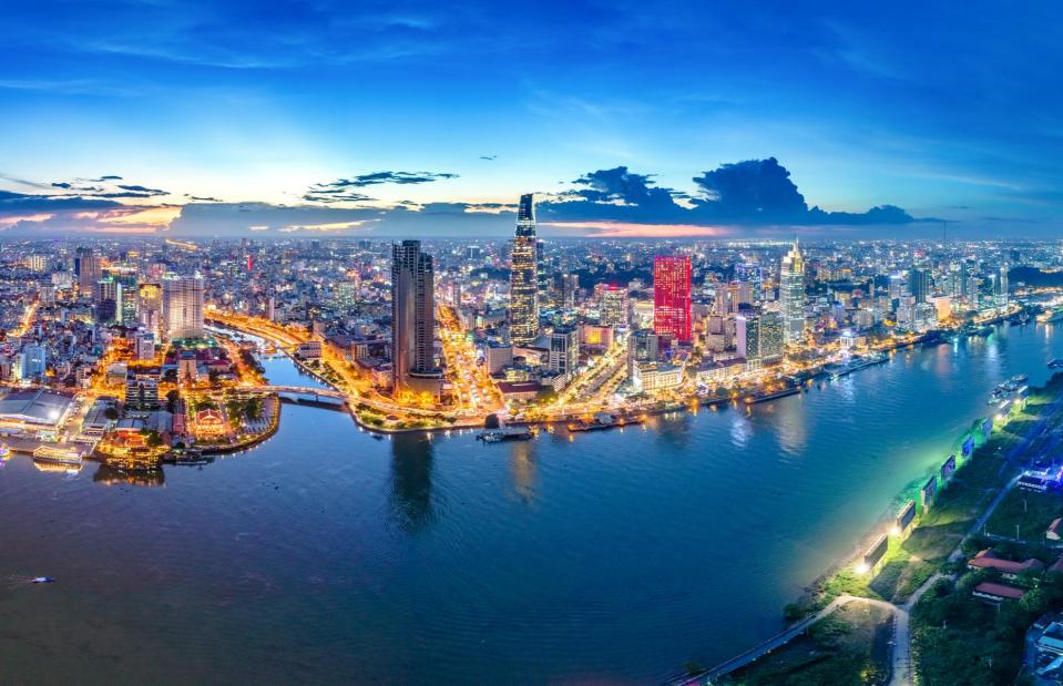
Nguyen Quang Ngoc Tonkin/Shutterstock
If the sea levels continue to creep up as they are, much of Vietnam’s economic center Ho Chi Minh City will be underwater along with the majority of the populous, flat coastal regions south of the city. The hectic city, once known as Saigon, is home to some eight million people and is the location for many important Vietnamese historical and cultural attractions.
Hué, Vietnam
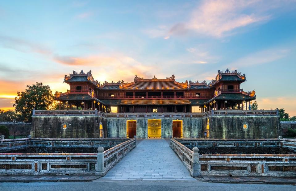
Nguyen Quang Ngoc Tonkin/Shutterstock
Central Vietnam, including the province of Thừa Thiên-Hué, is also under threat. Rising sea levels, combined with increased rain, will flood the low-lying plains in which the province sits – the royal city of Hué, which sits on the banks of Song Huong (the Perfume River), will likely be one of the hardest hit places.
As the political, cultural and religious center under the Nguyen dynasty until 1945, Hué's historic center has numerous UNESCO-listed monuments, including palaces and temples.
Adriatic Coast, Italy
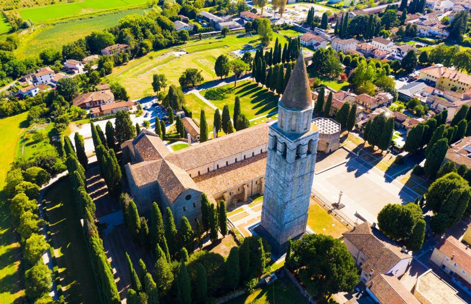
Iakov Filimonov/Shutterstock
The projected sea-level rise for the Mediterranean will affect numerous incredible places, particularly on the coast of the northern Adriatic. Venice’s fight against the rising tide is well documented, but the town of Aquileia (pictured) is also in the red zone, according to Climate Control’s data.
The pretty country town, home to a UNESCO-listed basilica, was once one of the largest and richest cities of the Roman Empire – and it's the site of one of the most complete, unexcavated Roman sites in Europe.
Adriatic Coast, Italy
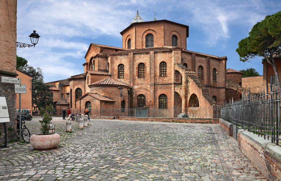
Ermess/Shutterstock
Another treasure trove of Roman remains and Byzantine mosaics at risk from the rising sea is Ravenna, on Emilia-Romagna’s Adriatic coastline. Coastal flooding could do untold damage to this pretty town, which lies just a few miles from the Adriatic and is known for its elegant piazzas and priceless mosaics. The Basilica di San Vitale (pictured) is Ravenna’s most famous site.
Thessaloniki, Greece
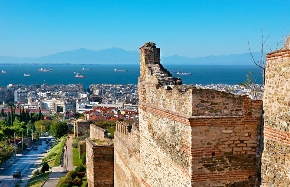
eFesenko/Shutterstock
Water is intertwined with the history of Greece’s second city, which was founded in 315 BC and is set on the northern edge of the Thermaic Gulf. With its mighty fortifications, many churches and ancient monuments, Roman, Christian, Byzantine and Venetian influences are evident throughout Thessaloniki. However, the Thermaic Gulf is one of the Mediterranean danger zones and is vulnerable to rising sea levels.
Andalucía, Spain
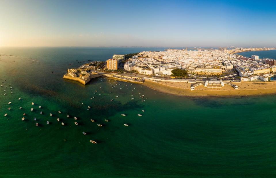
Iulius Agency/Shutterstock
Western Europe’s oldest existing city is also in peril: Cádiz, along with other parts of Andalucía, will be severely affected by climate change. The port was founded by the Phoenicians over 3,000 years ago, but sea levels could mean coastal floods wreak havoc on the city’s cobblestoned center, pretty tree-lined plazas and historic sea fortifications.
Andalucía's lower Guadalquivir River area is in danger of flooding too, which would have ramifications for parts of the region’s riverside capital Seville.
Alexandria, Egypt
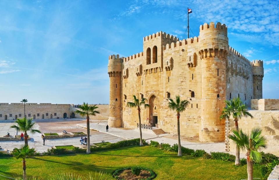
eFesenko/Shutterstock
There are more cultural heritage sites at risk in Egypt’s ancient seaport of Alexandria. Founded by Alexander the Great around 330 BC, the modern metropolis could be lost to rising waters by 2050.
Key sites include the Citadel of Qaitbay, built where the legendary Pharos lighthouse once stood, Pompey’s Pillar and the ruins of the temple of Serapeum, and the Bibliotheca Alexandrina, a modern library built in remembrance of the city’s revered ancient library and one of Egypt’s major cultural venues.
Port Douglas, Australia
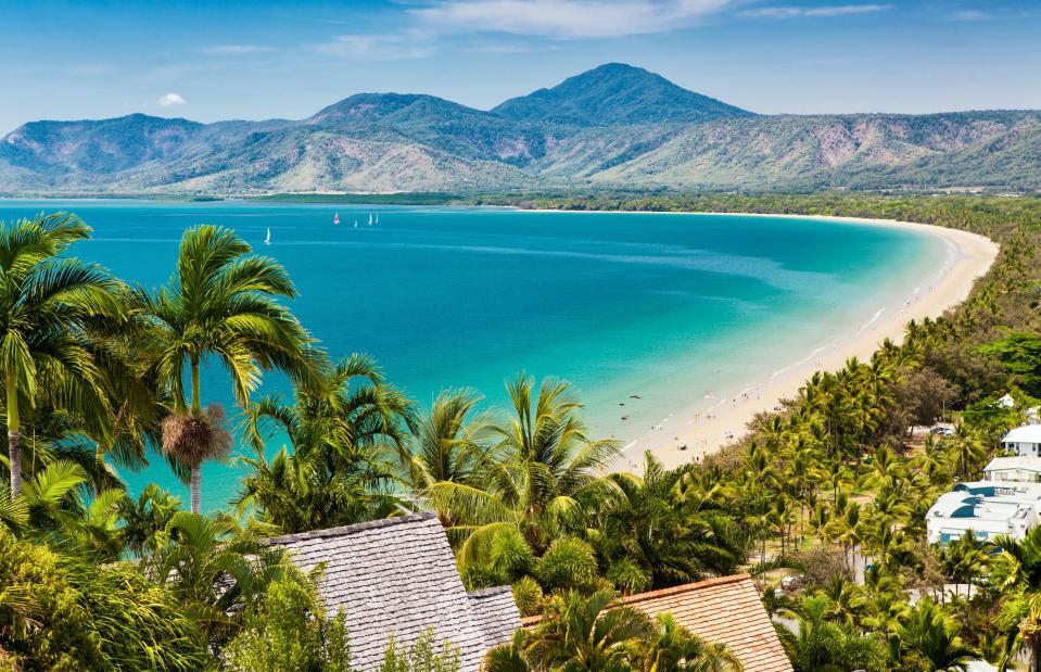
Martin Valigursky/Shutterstock
Australia is facing major risks to its coastal infrastructure. According to the study, much of the east coast is on course for a sea-level rise that would impact many of Queensland’s most popular tourists spots. Pretty Port Douglas in far-north Queensland is one town that could be swamped.
The Climate Control data indicates that parts of Daintree National Park, home to the world’s oldest tropical rainforest, will also be affected, and the events will pose a major risk to the fragile ecosystems of the Great Barrier Reef.
Kuching, Malaysia
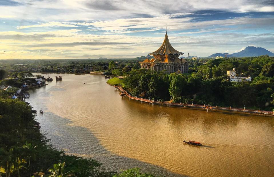
Kolokmee/Shutterstock
Kuching, Sarawak’s beguiling riverside capital, is at risk of being inundated by flood waters, according to the data. The city, in the Malaysian state of Sarawak, on the island of Borneo, has a beautiful historic waterfront area and a well-preserved Chinatown.
Among its architectural treasures is a 19th-century Old Court House that’s now an impressive cultural hub. The entire surrounding suburb of Petra Jaya may also be underwater within the next three decades.
Mumbai, India
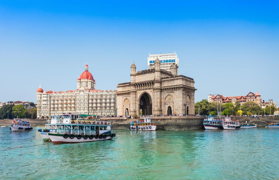
aiko3p/Shutterstock
The new projections by Climate Control show that Mumbai, India’s financial capital and one of the largest cities in the world, is at risk of being largely wiped out. Built on what was once a series of islands, the city’s historic downtown core is particularly vulnerable.
Its iconic Gateway of India stone arch, which presides over the Mumbai harbor waterfront, and an ancient complex of rock-cut caves on Elephanta Island could be among the incredible places to be engulfed by the Arabian Sea.
Kolkata, India
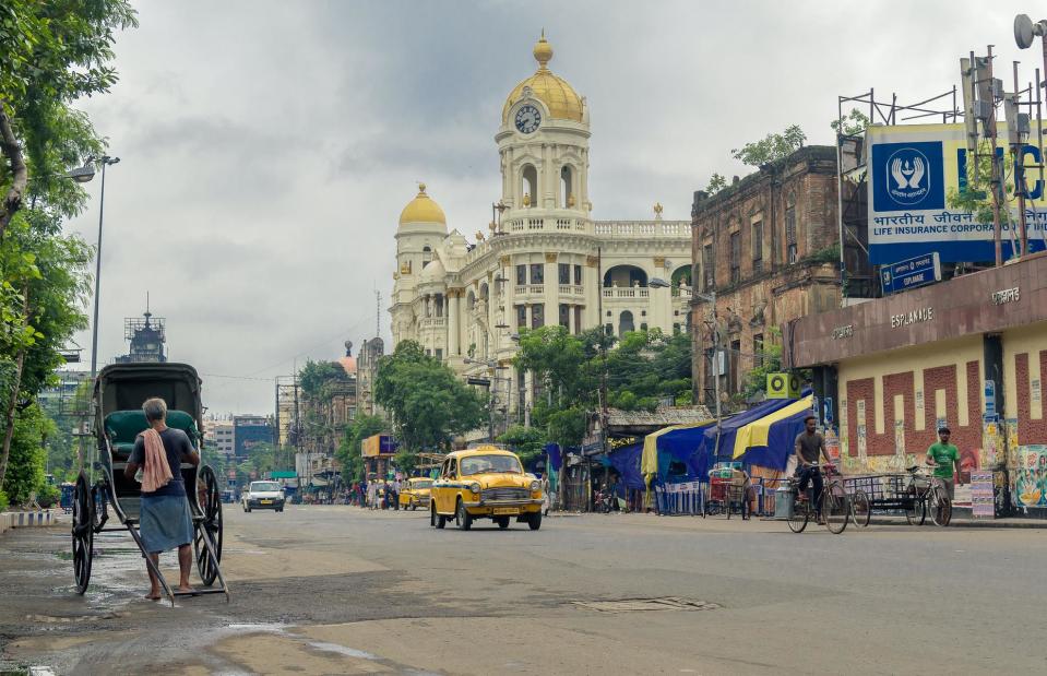
ABIR ROY BARMAN/Shutterstock
Kolkata is another of India’s populous low-lying coastal cities in danger of sinking completely below water by 2050. It sits on the east bank of the Hooghly River (known as Ganga), which flows to the Bay of Bengal (thought to be rising more than three-and-a-half times faster than the Arabian Sea).
Known as India's cultural capital, Kolkata is packed with heritage sites including old Hindu temples, grand colonial-era palatial mansions, the country’s only Chinatown and the Mother House where Mother Teresa lived and is buried.
Bangkok, Thailand
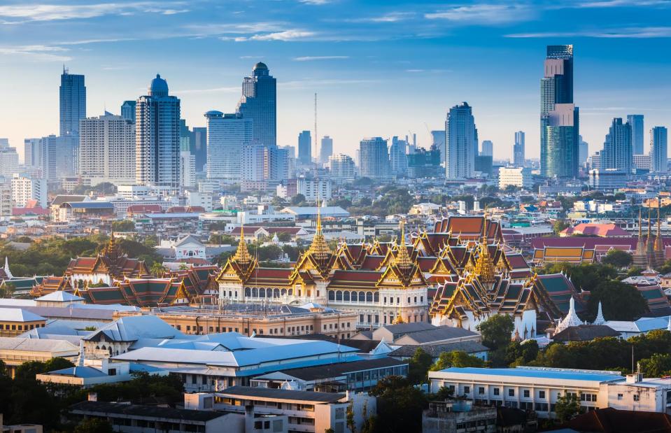
TWStock/Shutterstock
Home to an estimated 10 million people, Thailand’s sprawling capital is sinking and is likely to be one of the cities worst hit by rising sea levels, according to Climate Central's data. The megacity, which sits on the delta of the Chao Phraya River and is laced with canals, has suffered major floods in recent years, with buildings eroded by rising waters.
But soon it could sink into the sea entirely, taking with it ancient temples, holy shrines and opulent palaces.
Shanghai, China
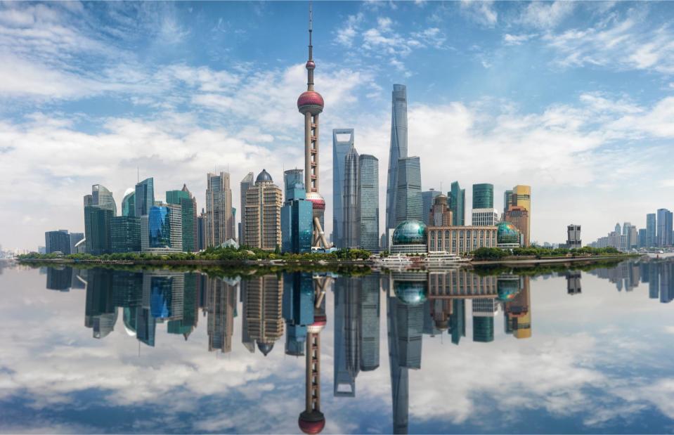
Sven Hanschec/Shutterstock
Shanghai translates as “city on the sea”, but the megacity could soon be under the sea, according to the data from Climate Control – in fact, it is one of China's most endangered cities. The Yangtze Delta where Shanghai is located – as well as the Pearl River Delta, home to Guangzhou, capital of the Guangdong province – are extremely vulnerable to flooding with perilously high concentrations of people living on low-lying land.
Manila, Philippines
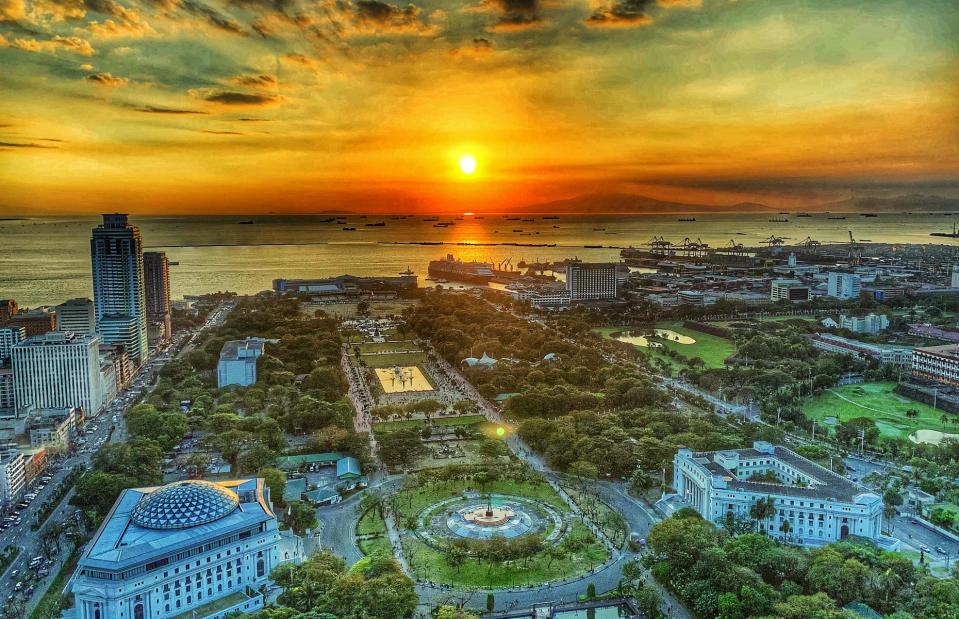
Aragorn_19/Shutterstock
Another Asian megacity extremely vulnerable to rising sea levels is Manila in the Philippines, which is home to around 6.8 million people. According to the map, the capital will be submerged by 2050, along with other parts of the Pacific Ocean archipelago. The report found that 5.4 million Filipinos are already living on land set below annual flood levels.
Mozambique
Tonis Valing/Shutterstock
Mozambique has one of the longest and most stunning coastlines in Africa. As a result, it will be also be one of the continent’s countries most affected by rising sea levels. More than 60% of Mozambique's population lives in low-lying coastal areas identified as at risk. Coastal floods could threaten the lives of millions, as well as destroy infrastructure and various important ecosystems such as coral reefs, mangroves and seagrass.
Mozambique
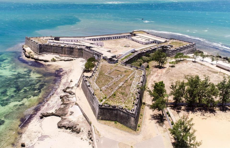
maloff/Shutterstock
The east African country is already prone to coastal flooding, but by 2050 large parts will be entirely lost to the sea, according to the report. As well as capital Maputo, parts of the Maputo Elephant Reserve will be lost, and Mozambique Island will be submerged in its entirety. The crescent-shaped coral isle, with its vast fortress and Stone Town, was the capital and trading center of Portuguese East Africa and is a UNESCO World Heritage Site.
Hudson Bay, Canada
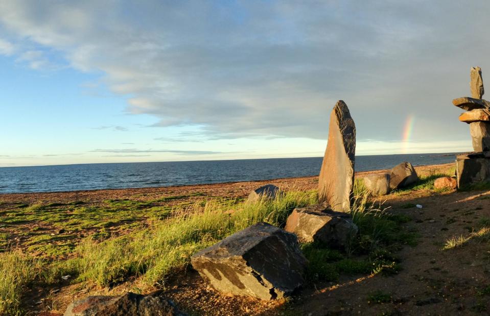
Wlkellar/Shutterstock
The coastline of the Manitoba province in the Canadian Arctic is facing a worrying future. Churchill, the so-called Polar Bear capital on the remote southwestern shores of Hudson Bay, is already feeling the effects of climate change with severe spring floods becoming more common.
But it could eventually be underwater entirely, putting at risk historic sites including inukshuk built by the Inuits and the 18th-century Prince of Wales Fort. Parts of its Wapusk National Park, which contains one of the world’s largest known polar bear maternity denning areas, will also disappear.
Charleston, South Carolina, USA
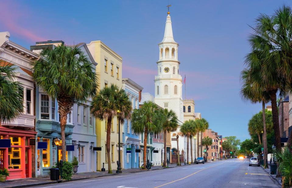
Sean Pavone/Shutterstock
When it comes to rising seas, the South Carolina beauty of Charleston is a risky city to live in, according to the report. It found that there was a 34% risk of at least one flood over five feet (1.5m) taking place between now and 2050 in the Charleston County area. This leaves the historic city's buildings and homes very vulnerable to damage and destruction, particularly in its low-lying areas.
Storm surges along Charleston Harbor are likely to become more commonplace and severe.
St Augustine, Florida, USA
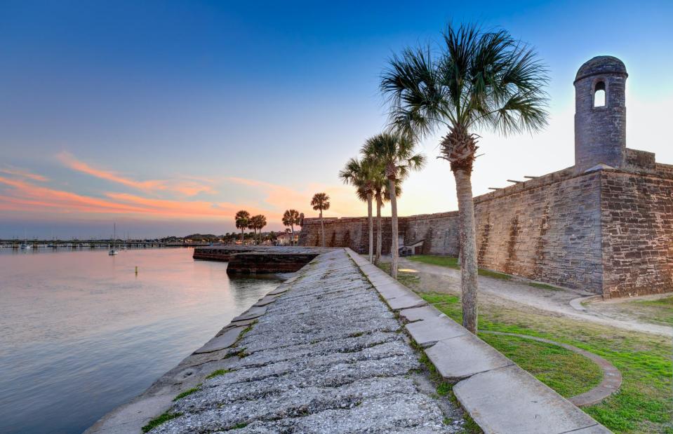
Jo Crebbin/Shutterstock
Flooding has long blighted America’s oldest city, St Augustine – and it will continue to do so since the city is reportedly one of the East Coast locations most under threat. According to the report there is a 64% risk of at least one flood over four feet (1.2m) taking place between today and 2050 in the St Augustine area.
In 2016, Hurricane Matthew unleashed unprecedented flooding on the city's historic downtown area, which is presided over by waterside fort Castillo de San Marcos, built by the Spanish in 1672.
Everglades National Park, Florida, USA
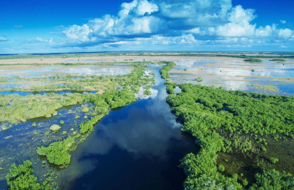
Pisaphotography/Shutterstock
The creeping sea is already having an effect on the southern part of Florida’s vast tropical wetlands and will continue to decimate the unique habitat if unchecked. The increasing sea level is pushing saltwater inland, causing the freshwater marshes to shrink and coastal mangroves to head inland. The wilderness is home to threatened species such as the manatee, the American crocodile and the Florida panther.
Florida Keys, USA
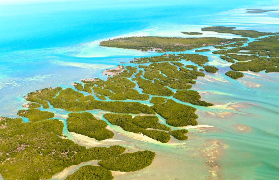
Bertl123/Shutterstock
Much of the largely flat southern Florida coastline faces inundation by 2050, and this includes its stunning coral cay archipelago, the Florida Keys. In fact, Key West is likely to be one of the first US cities to start flooding thanks to rising sea levels. By 2060, it’s estimated that over 60% of the liveable land there will be flooded (rising to nearly 95% in 2100).
New Orleans, Louisiana, USA
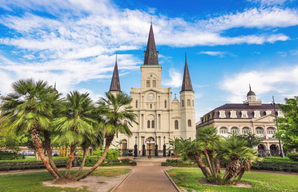
Sean Pavone/Shutterstock
With much of the so-called Big Easy below sea level, residents of Louisiana’s flood-prone city, and its beautiful heritage buildings, face a perilous future. After being devastated by Hurricane Katrina in 2005, a $14 billion network of levees was built to protect the city. But if sea levels continue to rise the sinking city could be overtaken.
The Climate Central report points to an 89% risk of at least one flood over six feet (1.8m) taking place between today and 2050 in the New Orleans area.
San Francisco Bay Area, California, USA
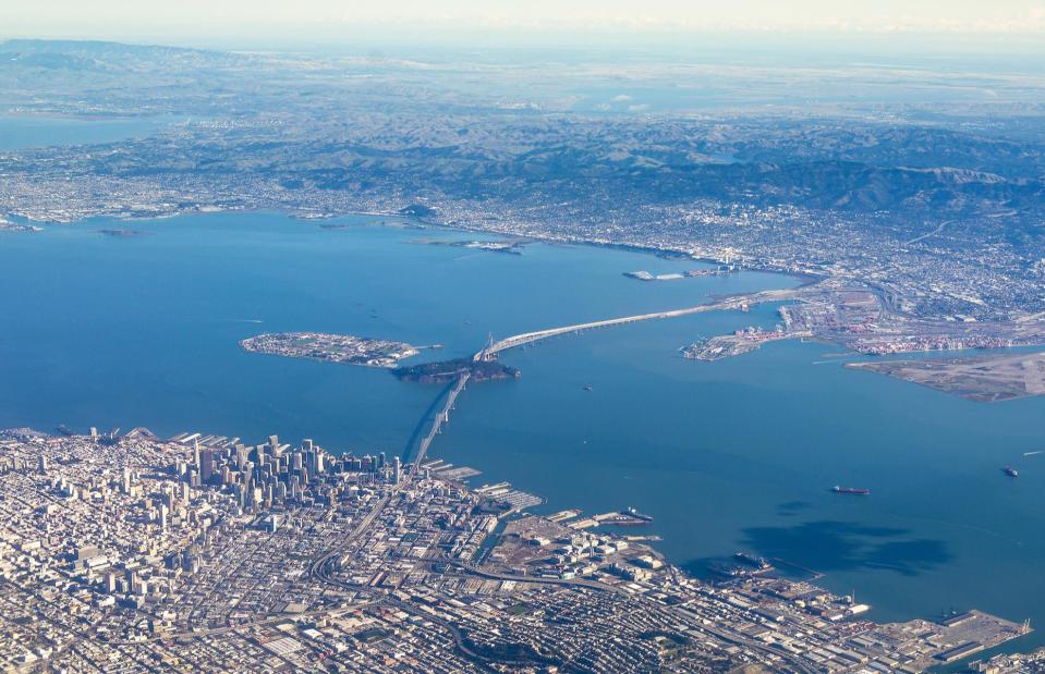
Mark Schwettmann/Shutterstock
On the USA's West Coast, the San Francisco Bay Area looks set to be most at danger from major flooding due to the sea-level rise. Climate Control's Coastal Risk Screening Tool shows extreme flooding at locations around the Bay Area, putting parts of San Francisco, Oakland and Foster City underwater by 2050.
Also underwater is the San Pablo Bay National Wildlife Refuge, a tidal marsh, mud flats and important wetland habitat in Sonoma County, with the flooding rising up close to the wine-growing town of Napa and capital Sacramento.
London, UK

Ingus Kruklitis/Shutterstock
Global warming has put London at risk of sinking, along with other major cities, as rising sea levels spell more flooding along the Thames estuary, according to the Climate Central report. Without radical coastal reinforcement strategies, the rise would see large parts of the capital underwater.
Particularly vulnerable areas lie along the length of the River Thames, setting for some of the capital's most important buildings such as the Tower of London and Houses of Parliament and cultural spaces including the Tate Modern and Shakespeare's Globe.
New York City, New York, USA
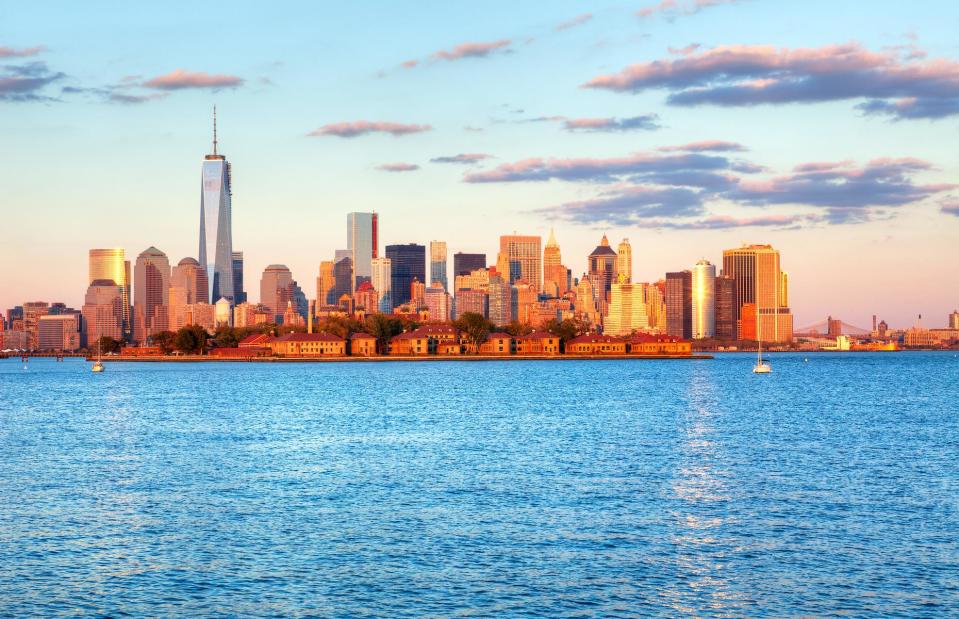
Anton Foltin/Shutterstock
Another of the world’s major cities facing an uncertain future is New York City – in fact, the entire state of New York is under threat. According to the report, there is a 68% risk of at least one flood over six feet (1.8m) taking place between today and 2050 in the New York area.
This could do irreparable damage to the city’s waterfront districts in particular – in 2012 tidal surges from Hurricane Sandy damaged the neighborhoods of Lower Manhattan, Red Hook and the Rockaway Peninsula.
Tuvalu

Mario Tama/Getty Images
Since the release of Climate Central's data, more worrying climate change reports have been published, revealing more places at risk of being submerged. New evidence from the United Nations Intergovernmental Panel on Climate Change has found that sea levels are expected to rise by a further six to 10 inches (15 to 25cm) by 2050.
This puts the tiny Pacific nation of Tuvalu under serious threat. The nine low-lying islands, located between Australia and Hawaii, have a high point of just 16.4 feet (5m) above sea level, with the main island of Fongafale just 66 feet (20m) across at its narrowest point.

