
UK weather forecast: Storms set to continue as England hit by flash flooding
Brits have been told to brace for more storms this weekend after heavy rain and flash flooding caused disruption to roads and railways last night.
The Met Office has issued yellow thunderstorm warnings for England and all of Wales until Monday, with the potential for flooding and damage to buildings from lightning and hail.
Storm warnings for Friday cover all parts of England south of York and the entirety of Wales, and the Met Office said lightning and flooding also pose a risk of delays or cancellations to train and bus services, and of road closures and power cuts.

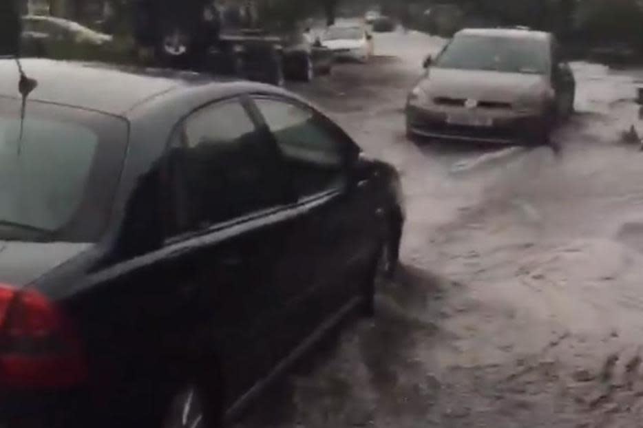
After another day of hot weather, storms struck in various parts of the country on Thursday night, with areas around Maidenhead, Berkshire, particularly hard hit.
Pictures of flash flooding on the on the M25 near Redhill and Croydon showed the impact of the storm.
Further south, the M23 was one of many roads affected by the deluge, being temporarily closed in both directions between junctions eight and seven.
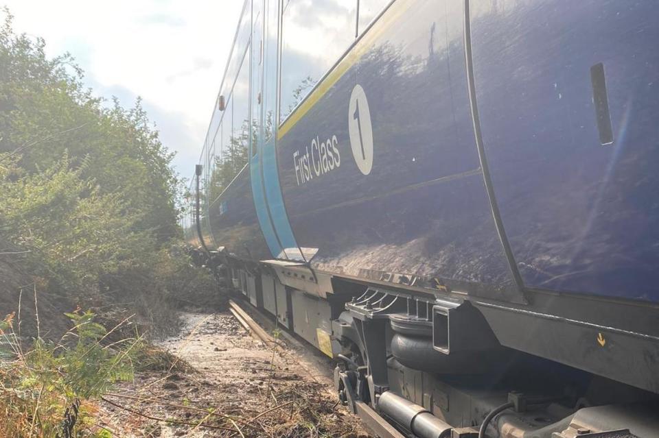
Heavy rain which lashed southern England on Thursday afternoon forced parts of the M25 to be closed, while passengers were evacuated from a train which became stuck following a landslide in Kent.
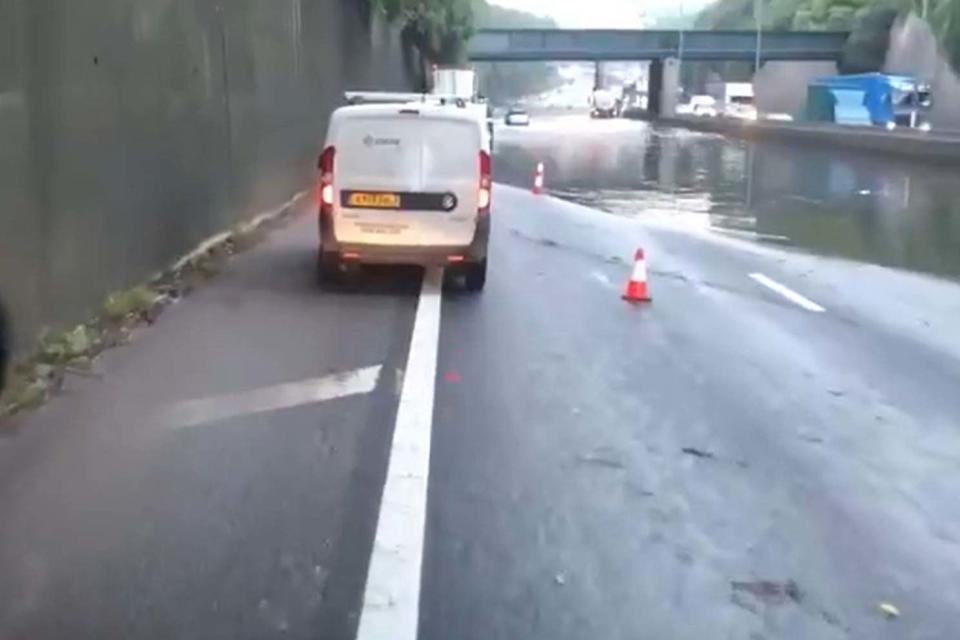
The Roads Policing Unit for Surrey Police tweeted the M25 was closed between junction six and eight to allow authorities to pump water off the road and allow those trapped on the hard shoulder to make their way through.
Meanwhile, 19 people were evacuated from a train which became stuck following a landslide, according to British Transport Police.
The train came to a halt between West Malling and Borough Green in Kent and rescue attempts were hindered by localised flooding, Network Rail said
A tweet by Network Rail Kent and Sussex said teams would be working overnight to clear mud which was washed onto the railway by torrential rain in the area.
Met Office chief meteorologist Frank Saunders said: “Up until Monday, thunderstorm warnings cover much of England and Wales, with parts of southern England and South Wales seeing the greatest likelihood of impacts.
“The storms will not affect all areas, but where they happen there will be frequent lightning, gusty winds and intense, heavy downpours with 30 to 40 millimetres of rain possible in less than an hour and, in a few unlucky spots, a small chance of 60 mm falling in a short period.
“With the continuing hot weather, large swathes of the UK continue to be at risk from thunderstorms, and potentially the impacts from heavy rain, into the early part of next week.”
Neil Davies, Flood Duty Manager at the Environment Agency, said: “Isolated thunderstorms could bring sudden surface water and river flooding, which may lead to flooded properties and severe travel disruption in some areas. Further surface water and river flooding is also a possibility until Sunday.”
The Environment Agency has a warning for expected flooding at Winford Brook at Chew Magna, south of Bristol, along with six alerts for possible flooding around Birmingham.
Avon and Somerset Police were warning of delays on the A38, which was closed in both directions in Winscombe north of the A371 junction overnight after a burst water main caused a sink hole, in which a coach became stuck.
Additional reporting by PA Media.
Read more
Warning of more thunderstorms after record run of hot weather
Brits brace for six days of thunderstorms amid historic heatwave
Thunderstorms and lightning warning as temperatures to top 31C

