
Weather forecast: Amazing images show UK turning brown amid unusually dry summer

Amazing images show the UK turning brown during a scorching summer which is on track to be one of the hottest on record.
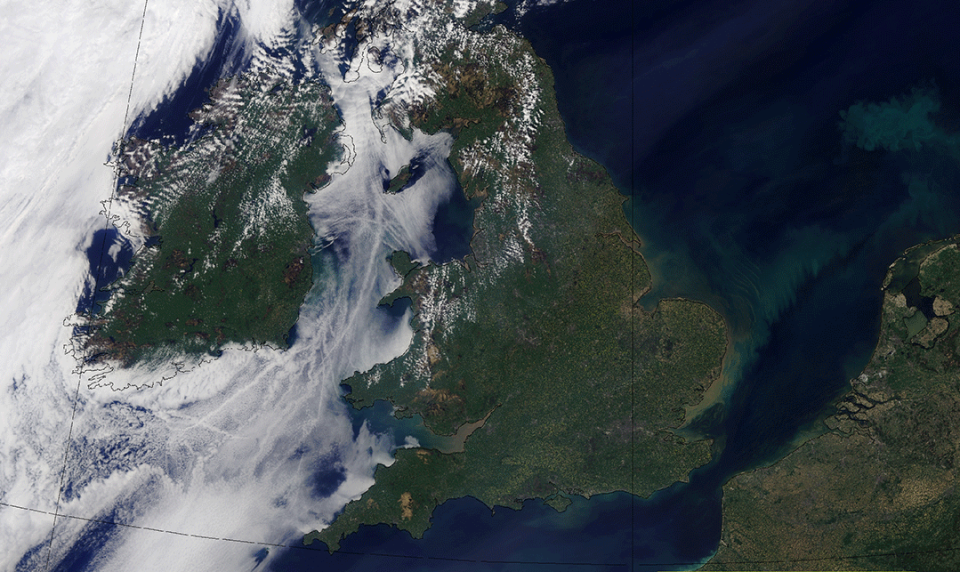
The satellite photos, supplied by the Met Office, compare the colour of the country in July to what it was back in May.
Recent months have been unusually dry, with an average of just 47mm falling in England, Scotland, Wales and Northern Ireland.
That makes it the driest start to summer since modern records began in 1961, followed by 2013 when there was 59mm more rain.
Amid the heatwave, parts of Northern Ireland have been forced to introduce a hosepipe ban, while the north west of England also issued a ban this week.
Major wildfires have raged, including a huge blaze across Saddleworth Moor in Greater Manchester and the largest grass fire in the London Fire Brigade's history on Wanstead Flats, east London, on Sunday.
Met Office spokesman Grahame Madge said: “It has been the driest start to the summer since modern records began in 1961, with the UK having just 47mm of rain so far.
“If you were to see this trend carrying on for the rest of the summer then we could obviously see the hottest summer since 1961, and almost certainly since before then as well.

“At this time in 1995, the second hottest summer, there was over 60mm of rain.
“When you look at the top ten this summer has been considerable drier than the rest.”
Mr Madge added the reason that the weather has been so unusual is because an area of high pressure has settled above the UK and is refusing to budge.
He said: "The reason for this is that high pressure has dominated the UK. A dense pool of air is sat over the UK which sinking, suppressing cloud development.
“It not east for low pressure weather systems to come in and budge it out of the way.
"This very sluggish polar jet stream across the Atlantic, which tends to bring areas of low pressure towards the Uk, is particularly sluggish.
“As a result it looks like this system will be in place for a long time.”

