
From rugged moorland to gorges carved by ice, the best walk in Yorkshire

On a quest for genuine hiking highlights, these are the best routes in the heart of James Herriot country
Like its no-nonsense inhabitants, rugged authenticity defines Yorkshire’s many different landscapes. For many, this is exemplified by the criss-cross lines of drystone walling that sketch out across the fields and meadows to separate man’s domain from nature’s fantastical doodlings, with her tarns, gills, becks, scars and forces. For others, it is the simple fact that Yorkshire can never be mistaken for anywhere else.
North Yorkshire has two national parks, the Yorkshire Dales in the west and the North York Moors in the east. The landscapes of the former are an extension of the Pennines – the spine of England’s North – and were formed after the last Ice Age when the melting ice caps created vast rivers that carved deep gorges into the limestone beneath.
In contrast, the North York Moors contains the largest area of heather moorland in England and Wales, and is home to the 109-mile Cleveland Way, which traces a horseshoe around said moors. Less well-known are its lowland valleys, which host one of the largest concentrations of ancient trees in northern England.
All these trails pass through the heart of James Herriot country. The Yorkshire vet’s books inspired TV’s All Creatures Great and Small, the latest version of which recently hit our screens.
To celebrate the 50th anniversary of Herriot’s first book, a new company offering self-guided walks, Muddy Boots, has launched a series of itineraries researched by locals with off-the-beaten-track routes through the most dramatic scenery while staying at the best pubs and B&Bs along the way.
North York Moors
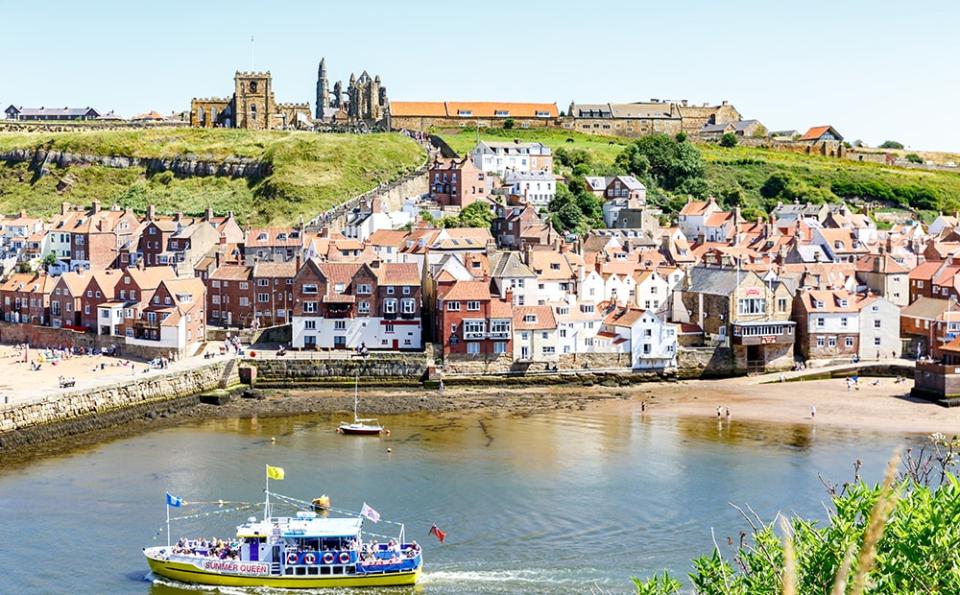
Esk Valley Walk (Lealholm to Whitby)
The River Esk flows through this most beautiful of English valleys from high on the moors to Whitby on the coast. Its wooded gorges are punctuated by ancient stepping stones across the rivers and, if you’re in luck, the chuffing of steam trains on the nearby railway.
Distance: 14 miles
Map: North York Moors (East) OL27
Route: Follow the Esk Valley Walk east from Lealholm to Whitby. The waymark logo is of a leaping salmon.
Helmsley to Rievaulx Abbey
More atmospheric medieval ruins top and tail this walk with superb woodland views over Rye Dale. Helmsley is home to an 11th-century castle and a Tudor mansion, while the 12th-century Cistercian Abbey at Rievaulx was one of the most important monasteries in the North.
Distance: Eight miles
Map: North York Moors (West) OL26
Route: From Helmsley, take the Cleveland Way along Rye Dale before following the small road north and then east keeping the abbey on your right. Follow the wide track to Griff Farm and back to the Cleveland Way to Helmsley.
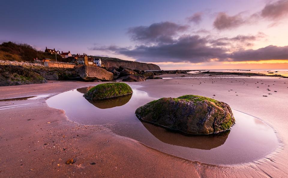
Ravenscar to Robin Hood’s Bay
A combination of moorland and exhilarating clifftop stretches, this walk takes in Howdale Moor, the abandoned Scarborough-to-Whitby railway line, and the smugglers’ cove of Boggle Hole in Robin Hood’s Bay.
Distance: 12 miles
Map: North York Moors (East) OL27
Route: From Ravenscar, follow the path south-east across the moor and then north to the abandoned railway line, which leads all the way to beautiful Robin’s Hood’s Bay. Then head south along the coast back to Ravenscar.
Sutton Bank to Boltby
Described by James Herriot as having the best views in England, Sutton Bank looks out over the Vale of Mowbray towards the Pennines, with Great Whernside in the Yorkshire Dales visible on a clear day; epic by anyone’s book.
Distance: Seven miles
Map: North York Moors (West) OL26
Route: From the visitor centre at Sutton Bank, take the nature trail path to Gormire Lake before heading north to the village of Boltby returning to the start along the Cleveland Way.
Yorkshire Dales
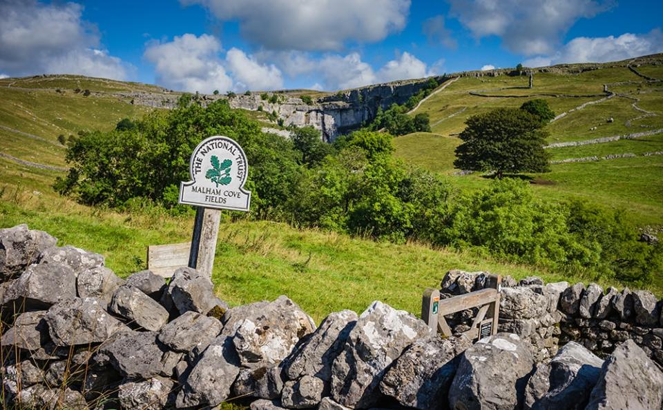
Gordale Scar & Malham Cove
A Dales classic to stir the spirit. Its highlights include Gordale Scar’s giant limestone cliffs, Malham Cove – a dried-up Ice Age waterfall 260ft high by 980ft wide – and serene Malham Tarn, which is the highest natural lake in England and the home of endangered water voles.
Distance: Eight miles
Map: Yorkshire Dales (South/West) OL2
Route: From Malham, follow the path to Janet’s Foss waterfall and into Gordale Scar. Scramble to the top and across the grassy uplands to Malham Tarn. Then join the Pennine Way heading south through Malham Cove and back to the start.
Kisdon Gorge
Kisdon Gorge on a sunny day is hiking heaven and the tiers of Swinner Gill’s waterfalls are wild swimming heaven. And that’s before you reach the weird ruins of Crackpot Hall and the stunning views over Swaledale.
Distance: Seven miles
Map: Yorkshire Dales (North/Central) OL30
Route: From Muker, follow the River Swale through Kisdon Gorge and into Swinner Gill to the abandoned lead mine. Return via Crackpot Hall past Keld and then south along the top of the gorge.
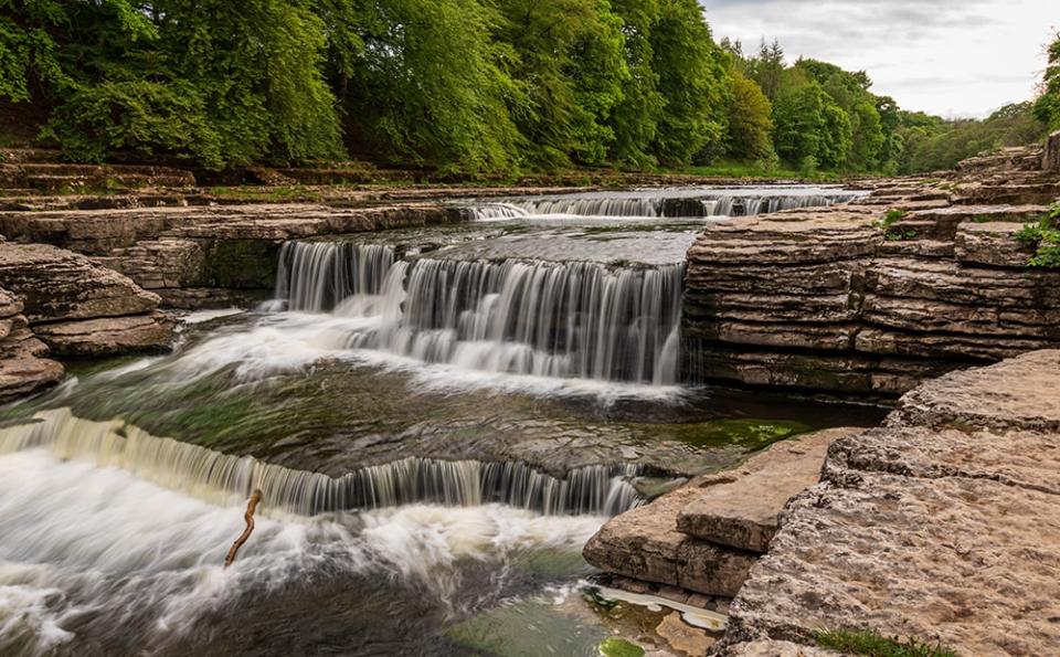
Aysgarth Falls & Castle Bolton
Yorkshire took centre stage in many medieval power struggles and the square towers of Bolton Castle held Mary, Queen of Scots, prisoner in 1568. Visit during an inspiring walk topped and tailed with a famous waterfall and great views.
Distance: Eight miles
Map: Yorkshire Dales (South/West) OL2
Route: From Aysgarth Falls, follow the footpath across the fields to Castle Bolton (the name of the town) before tracking west along the edge of the moor to the village of Carperby and back to Aysgarth.
Jervaulx Abbey & Middleham Castle
A time-capsule of a walk taking in both the ruins of the Cistercian Abbey at Jervaulx, and Middleham Castle. Both were built in the 12th century, with the former falling prey to Henry VIII, while the latter fell into ruin during the 17th century.
Distance: 14 miles
Map: Yorkshire Dales (North/Central) OL30
Route: From East Witton follow the wooded riverbanks of first the River Cover to Middleham and then the River Ure to Jervaulx while skirting Witton Fell on the return leg.
Essentials
How to do it
Muddy Boots Walking Holidays offers self guided walking trips in the Yorkshire Dales (01969 663838; muddybootswalkingholidays.com).
Where To Stay
The Dales
The Lister Arms, Malham (01729 830444; listerarms.co.uk) is a popular pub with rooms. The Punch Bowl Inn in Swaledale (01748 886233; pbinn.co.uk) is a 17th-century inn with excellent food and welcoming staff.
The Moors
The Old Bears Barn B&B (01947 897506; oldbearsbarn.co.uk) in Lealholm has charming, attentive hosts and great views. The centrally located, 15th-century Black Swan at Helmsley serves great food.
More information
North York Moors National Park (northyorkmoors.org.uk); Yorkshire Dales National Park (yorkshiredales.org.uk). Travel within the UK is subject to restrictions.
Telegraph Travel and Country Walking magazine have joined forces to encourage Britons to discover more of the UK by clocking up 1,000 miles on foot this year. To tell us where you’re walking in 2020 and to find out how to get involved, use #walk1000miles or visit walk1000miles.co.uk

