Floods and travel chaos as UK hit with half a month's rain in a day - but prepare to sizzle
Storms and rain caused flooding and travel chaos across the south and east of Britain, but the wet weather is set to be followed by soaring temperatures.
The extreme conditions were caused by a plume of warm air rushing in from the continent, which is experiencing a heatwave that could bring record-breaking temperatures to France, Spain and Belgium.
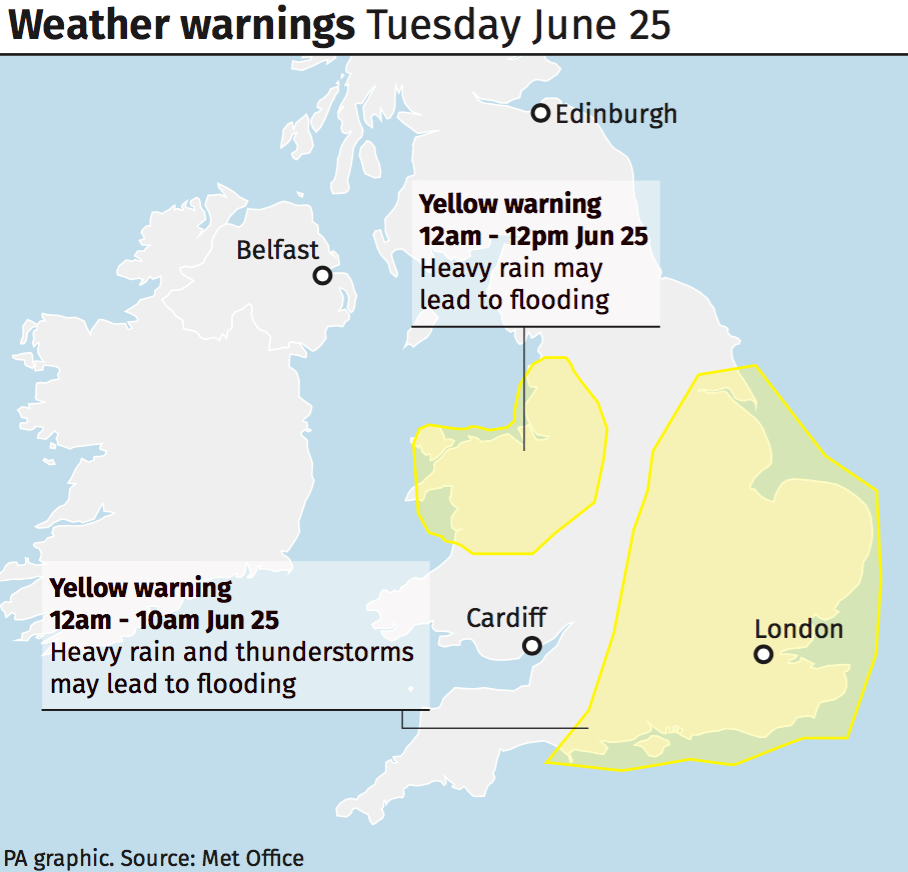
Almost half a month’s worth of rain fell in just a few hours in some areas of the UK on Tuesday morning, with Kent and Sussex the worst-hit.
Southern passengers were delayed by more than an hour after all lines from Brighton through Haywards Heath were blocked due to heavy rain and flooding on the tracks.


National Rail Enquiries warned the Gatwick Express, Great Northern, Southern and Thameslink services could be affected by rain, while Transport for London reported flooding on London roads.
The rain is easing as storms move north through England and Wales this afternoon, but the Met Office warned southern areas will become hot and humid.
The mercury is set to soar as the week progresses, hitting 30C in the south-east of England by the weekend. Sunbathers were warned to watch out for very high UV levels.
#Hot 🌞 and #humid 😎 weather has arrived. Different parts of the UK will be hot on different days. Take a look at the forecast maximum temperatures 🌡️ for your part of the country: pic.twitter.com/0KLjqrEjmr
— Met Office (@metoffice) June 25, 2019
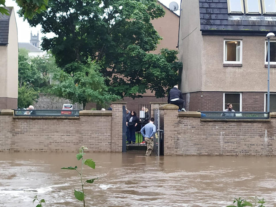
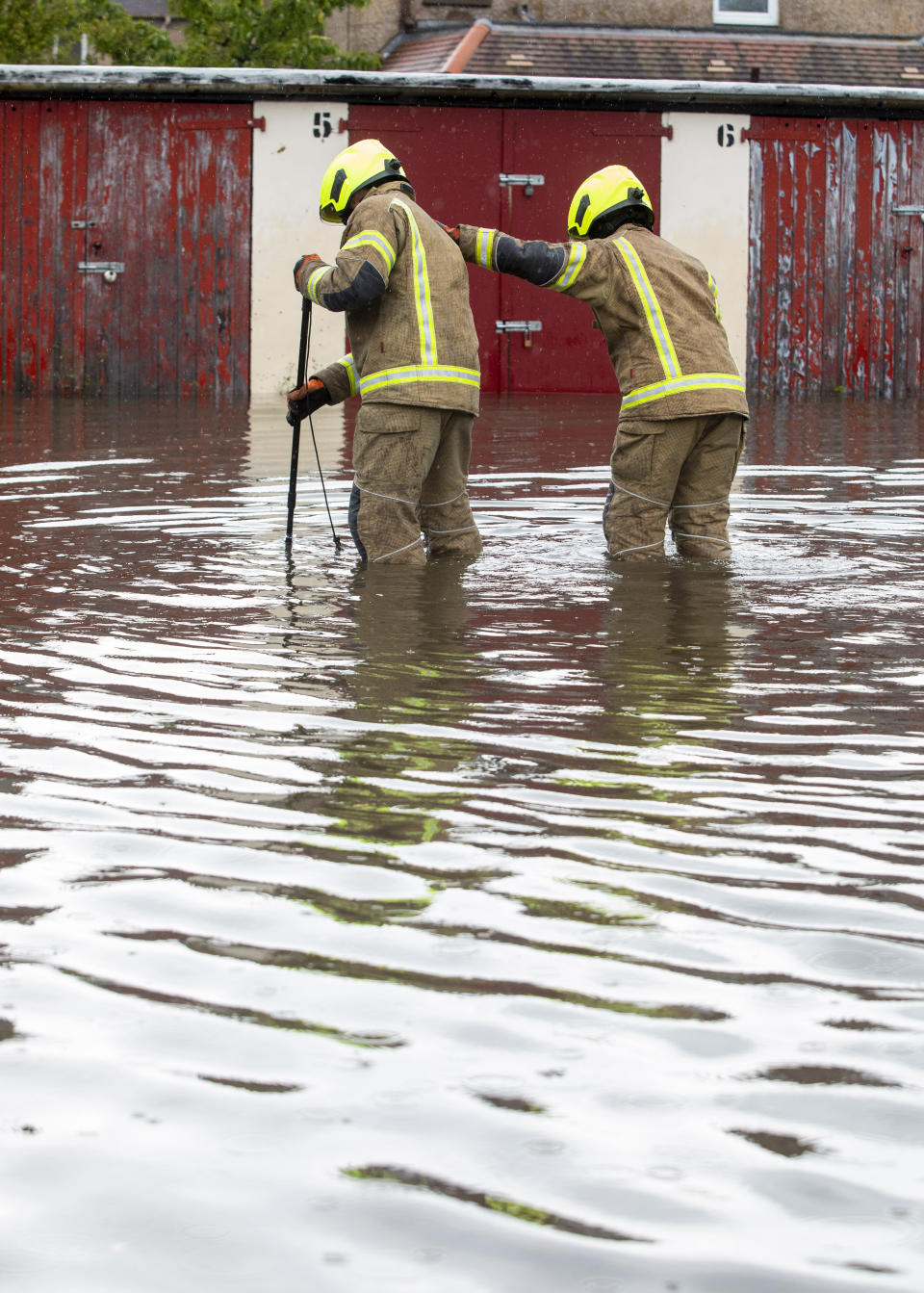
Roads were flooded in Edinburgh and the roof of a Tesco supermarket in Stirling, central Scotland, caved in after downpours, forcing the store to evacuate.
Met Office ‘danger to life’ weather warnings remained in place for almost all of the UK after Monday saw areas of the country hit by torrential rainfall - the Scottish capital received 44mm of rain, half its monthly total for July in just 24 hours.
As #rain 🌦️ moves further north through England and Wales this afternoon it will become light and patchy. Southern areas will become #hot and #humid 🌞 with just the chance of a shower pic.twitter.com/Fh4P0ti4Z9
— Met Office (@metoffice) June 25, 2019
This led to flash flooding ,which saw motorists abandon their vehicles and rendered streets impassable for trams. It also caused power cuts for businesses and homes.
Hastings on the south coast was hit by 13mm of rain in just an hour this morning, which added to ‘challenging’ conditions for drivers on their way in to work.
Met Office meteorologist Simon Partridge said: ‘The storms have arrived along the south coast of England from the Isle of Wight to the Dover Strait with increasing amounts of thundery activity.
The Catch-up: Hottest ever June weather could be on the cards
‘The storms will continue north-eastwards over parts of East Anglia and the Humber before edging out over the North Sea.
‘There could be some localised flooding, but certainly some surface water flooding which can cause problems to drive through as well as spray.’